|
search place name
|
||
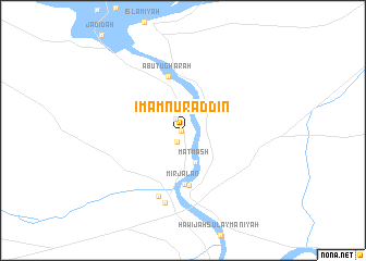
Imām Nūr ad Dīn (Al Anbār, Iraq)Imām Nūr ad Dīn is a town in the Al Anbār region of Iraq. An overview map of the region around Imām Nūr ad Dīn is displayed below.
regional and 3d topo map of Imām Nūr ad Dīn, Iraq ::
Nearby towns ::
Sulaymānīyah (0.1km west) //
Ḩadīthah (1.2km south west) //
Wasiţah (1.4km north west) //
Matmāsh (3.5km south) //
Mirjalān (5.5km south) //
Barwānah (5.7km south) //
Abū Ţughārah (5.6km north) //
Al Ḩaqlānīyah (7.1km south) //
Ḩawījat Arbān (7.6km south) //
[all distances 'as the bird flies' and approximate]  Places with similar names to Imām Nūr ad Dīn, Iraq :: Disclaimer :: Information on this page comes without warranty of any kind |
||
|
Where is Imām Nūr ad Dīn? Elevation and coordinates ::
Latitude (lat): 34°9'0"N Longitude (lon): 42°23'0"E
Elevation (approx.): 105m (map arrows pan, magnifying glasses zoom) |
||
|
Visiting Imām Nūr ad Dīn? Hotel/Accommodation ::
Book a hotel in Imām Nūr ad Dīn Travel Guide ::
Buy a travel guide for Iraq rental cars ::
car rental offers GPS waypoint ::
download a GPX waypoint (PoI) of Imām Nūr ad Dīn for your GPS receiver
|
||