|
search place name
|
||
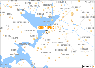
Kah Girdal (As Sulaymānīyah, Iraq)Kah Girdal is a town in the As Sulaymānīyah region of Iraq. An overview map of the region around Kah Girdal is displayed below.
regional and 3d topo map of Kah Girdal, Iraq ::
Kah Girdal airports ::
The nearest airport is SDG - Sanandaj, located 101.0 km east of Kah Girdal.
Other airports nearby include KSH - Bakhtaran Shahid Ashrafi Esfahani (151.5 km south east), Nearby towns ::
Kānī Shākh (0.9km north east) //
Kānī CharmḤk (1.2km north west) //
Qurtās (1.5km west) //
Zankāl (1.9km north east) //
Challga (2.4km south west) //
Sūrik (2.3km south west) //
Kularash (2.7km north east) //
Duwanza Imām (3.1km north east) //
Bizawa (3.4km south) //
Khirr-i Chālga Āshūr (3.5km south) //
Kularash (3.3km north east) //
Zardiyān (3.7km north) //
Nalarash (3.8km south west) //
Kēlaspī (4.1km north east) //
Bakrāwah (4.1km south east) //
Jānijān (4.5km north east) //
Kānī Tū (5.2km south) //
Dujaylah (4.4km north east) //
Hāō Raqa (5.0km north east) //
Tūwaqui (4.7km south west) //
Dujaylah (4.8km north east) //
Qaramānī (4.9km west) //
Faţh ‘Alī (5.8km north) //
Dalēn (4.9km east) //
Piris Khwāru (5.5km south east) //
Khulām-ē Sarū (6.2km south) //
Saysalmayn (5.4km west) //
Bashārat-i Khwāru (5.7km north east) //
Dar-ī Zahrinah (6.3km south west) //
[all distances 'as the bird flies' and approximate]  Places with similar names to Kah Girdal, Iraq :: Disclaimer :: Information on this page comes without warranty of any kind |
||
|
Where is Kah Girdal? Elevation and coordinates ::
Latitude (lat): 35°14'0"N Longitude (lon): 45°54'0"E
Elevation (approx.): 501m (map arrows pan, magnifying glasses zoom) |
||
|
Visiting Kah Girdal? Hotel/Accommodation ::
Book a hotel in Kah Girdal Travel Guide ::
Buy a travel guide for Iraq rental cars ::
car rental offers GPS waypoint ::
download a GPX waypoint (PoI) of Kah Girdal for your GPS receiver
|
||