|
search place name
|
||
Kūl Kātish (Arbīl, Iraq)Kūl Kātish is a town in the Arbīl region of Iraq. An overview map of the region around Kūl Kātish is displayed below.
regional and 3d topo map of Kūl Kātish, Iraq ::
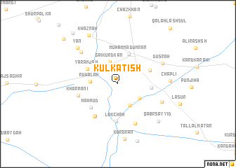
Nearby towns ::
Sai Kurd Kān (3.6km north) //
Al Mājīra (3.8km south east) //
Kurdah Chāl (3.6km south east) //
Ruwālah (3.6km west) //
Muḩammad ‘Umrān (4.9km north) //
Qīrah Sabīlkah (4.4km east) //
Yāramjah (4.6km north west) //
Kukrīyah (4.7km north east) //
Maḩmūd (5.2km south west) //
Lākchah (6.0km south) //
Girdhārah (5.9km south west) //
Kurdah Hārah (6.0km south west) //
Kharpānī (5.4km west) //
Bāsh Band (6.7km south) //
Kurdah Yūr (6.3km south east) //
Gumashīn (7.0km north west) //
Dūsrah (6.6km north east) //
Chāplī (6.8km east) //
Yan (7.8km north west) //
Qabr Sayyid (7.9km south east) //
Kurd Kān (8.8km south) //
Khaznah (8.6km north west) //
Gazūk (9.9km north west) //
Kardah (10.1km north west) //
Qal‘ah Lash Sūl (11.2km north east) //
[all distances 'as the bird flies' and approximate] 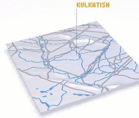 Places with similar names to Kūl Kātish, Iraq ::
// Goulou Goutchi (NE)
Disclaimer :: Information on this page comes without warranty of any kind |
||
|
Where is Kūl Kātish? Elevation and coordinates ::
Latitude (lat): 35°37'15"N Longitude (lon): 43°35'9"E
Elevation (approx.): 207m (map arrows pan, magnifying glasses zoom) |
||
|
Visiting Kūl Kātish? Hotel/Accommodation ::
Book a hotel in Kūl Kātish Travel Guide ::
Buy a travel guide for Iraq rental cars ::
car rental offers GPS waypoint ::
download a GPX waypoint (PoI) of Kūl Kātish for your GPS receiver
|
||