|
search place name
|
||
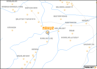
Māḩūr (Diyālá, Iraq)Māḩūr is a town in the Diyālá region of Iraq. An overview map of the region around Māḩūr is displayed below.
regional and 3d topo map of Māḩūr, Iraq ::
Māḩūr airports ::
The nearest airport is KSH - Bakhtaran Shahid Ashrafi Esfahani, located 175.9 km north east of Māḩūr.
Other airports nearby include SDG - Sanandaj (225.1 km north east), Nearby towns ::
‘Īsá al Muţlaq (2.8km south) //
Nu‘mah al Ḩalbūt (3.4km north east) //
Aţ Ţāli‘ah (4.0km north west) //
Jisr Nafţ (5.8km north west) //
Bustān Ras̄hid (7.1km north east) //
Ḩanash (8.0km south west) //
Imām al Hājj Yūsuf (7.4km east) //
Qaryat Shaykh Qāḑī (9.1km north) //
Nubī Tahrah (8.1km north east) //
Qal‘at Sayyid Furayḩ (8.7km north west) //
Mizil al Hamīd (9.5km south west) //
Ţalālah (9.8km south west) //
Shaykh Sa‘īd (10.3km north west) //
[all distances 'as the bird flies' and approximate]  Places with similar names to Māḩūr, Iraq ::
Disclaimer :: Information on this page comes without warranty of any kind |
||
|
Where is Māḩūr? Elevation and coordinates ::
Latitude (lat): 33°42'17"N Longitude (lon): 45°24'57"E
Elevation (approx.): 56m (map arrows pan, magnifying glasses zoom) |
||
|
Visiting Māḩūr? Hotel/Accommodation ::
Book a hotel in Māḩūr Travel Guide ::
Buy a travel guide for Iraq rental cars ::
car rental offers GPS waypoint ::
download a GPX waypoint (PoI) of Māḩūr for your GPS receiver
|
||