|
search place name
|
||
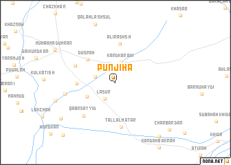
Punjiha (Arbīl, Iraq)Punjiha is a town in the Arbīl region of Iraq. An overview map of the region around Punjiha is displayed below.
regional and 3d topo map of Punjiha, Iraq ::
Nearby towns ::
Lāsūr (3.0km south west) //
Chāplī (2.8km west) //
Kard Karāwī (3.4km north) //
Kurdah Yūr (4.4km south west) //
Dūsrah (5.2km north west) //
Qīrah Sabīlkah (5.1km west) //
‘Alī Rashsh (6.3km north) //
Kukrīyah (5.9km north west) //
Tall al Maţar (7.2km south) //
Qabr Sayyid (6.9km south west) //
Kurdah Chāl (6.9km west) //
Bāsh Band (9.3km south west) //
Kurdī Rūī (10.4km south east) //
Chārbardān (10.5km south east) //
Dingāwah (11.0km south west) //
[all distances 'as the bird flies' and approximate] 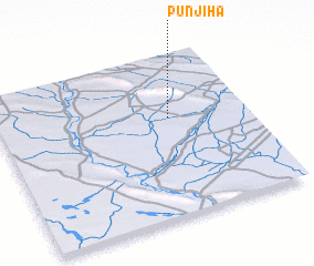
Disclaimer :: Information on this page comes without warranty of any kind |
||
|
Where is Punjiha? Elevation and coordinates ::
Latitude (lat): 35°36'58"N Longitude (lon): 43°41'25"E
Elevation (approx.): 223m (map arrows pan, magnifying glasses zoom) |
||
|
Visiting Punjiha? Hotel/Accommodation ::
Book a hotel in Punjiha Travel Guide ::
Buy a travel guide for Iraq rental cars ::
car rental offers GPS waypoint ::
download a GPX waypoint (PoI) of Punjiha for your GPS receiver
|
||