|
search place name
|
||
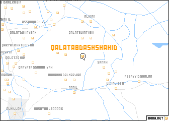
Qal‘at ‘Abd ash Shahīd (Bābil, Iraq)Qal‘at ‘Abd ash Shahīd is a town in the Bābil region of Iraq. An overview map of the region around Qal‘at ‘Abd ash Shahīd is displayed below.
regional and 3d topo map of Qal‘at ‘Abd ash Shahīd, Iraq ::
Nearby towns ::
‘Abd ‘Alī (3.7km west) //
Samāwī (4.0km south east) //
Mughīr as Salmān (4.7km south west) //
Qal‘at Buraysim (5.0km north) //
Gharrān (5.1km north) //
Qal‘at ‘Azīz (5.1km north) //
Muḩammad al Marjān (5.6km south west) //
As Sayyid Riḑāʼ (5.4km south east) //
Burhān (5.3km west) //
Sawādī (6.1km south east) //
Mundhir al ‘Azzah (6.4km south east) //
An Nīl (7.4km south) //
Falḩ Kāz̧im al Ibrāhīm (7.8km north east) //
Gharrān (8.7km north) //
Al Imām (8.7km north) //
Umm al Izba (8.5km south east) //
Salmān al ‘Umayr (9.5km north west) //
Shaykh Muḩammad Bayk (9.8km north west) //
[all distances 'as the bird flies' and approximate]  Places with similar names to Qal‘at ‘Abd ash Shahīd, Iraq :: Disclaimer :: Information on this page comes without warranty of any kind |
||
|
Where is Qal‘at ‘Abd ash Shahīd? Elevation and coordinates ::
Latitude (lat): 32°35'20"N Longitude (lon): 44°34'15"E
Elevation (approx.): 26m (map arrows pan, magnifying glasses zoom) |
||
|
Visiting Qal‘at ‘Abd ash Shahīd? Hotel/Accommodation ::
Book a hotel in Qal‘at ‘Abd ash Shahīd Travel Guide ::
Buy a travel guide for Iraq rental cars ::
car rental offers GPS waypoint ::
download a GPX waypoint (PoI) of Qal‘at ‘Abd ash Shahīd for your GPS receiver
|
||