|
search place name
|
||
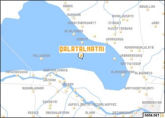
Qal‘at al Maţnī (Dhī Qār, Iraq)Qal‘at al Maţnī is a town in the Dhī Qār region of Iraq. An overview map of the region around Qal‘at al Maţnī is displayed below.
regional and 3d topo map of Qal‘at al Maţnī, Iraq ::
Qal‘at al Maţnī airports ::
The nearest airport is BSR - Basrah Intl, located 162.1 km south east of Qal‘at al Maţnī.
Other airports nearby include KWI - Kuwait Intl (278.0 km south east), Nearby towns ::
Zubayr (3.7km north) //
‘Alī al Fad‘am (5.8km north) //
Ḩasan ash Shabbāḩ (5.7km north east) //
Ḩusayn al Ḩunaysh (6.1km south west) //
Ḩusayn (6.0km north east) //
‘Uwayd al Khamīs (6.2km south west) //
Şaddām (7.1km south west) //
Kurd al Badr (6.8km south west) //
Ash Sharīfīyah (7.3km south) //
Rāḑī al Bishārah (6.3km east) //
Ḩusayn Ibn Ruwayţ (7.4km north) //
Umm as Sadd (7.3km north east) //
Ţal‘ah (7.3km south west) //
Sayyid Jābir (8.1km south west) //
Abū Samāḩ (8.1km south west) //
Manshad al Ḩabīb (8.4km south) //
Ziyādāt (8.4km north east) //
Abū Shambalānah (8.8km south west) //
Jazīrah (8.4km south west) //
Abū Gharīb (8.4km south west) //
Ziyādāt (9.8km north east) //
‘Ajīl aţ Ţarbūsh (9.6km north east) //
[all distances 'as the bird flies' and approximate] 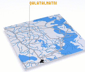 Places with similar names to Qal‘at al Maţnī, Iraq :: Disclaimer :: Information on this page comes without warranty of any kind |
||
|
Where is Qal‘at al Maţnī? Elevation and coordinates ::
Latitude (lat): 31°9'0"N Longitude (lon): 46°7'0"E
Elevation (approx.): 5m (map arrows pan, magnifying glasses zoom) |
||
|
Visiting Qal‘at al Maţnī? Hotel/Accommodation ::
Book a hotel in Qal‘at al Maţnī Travel Guide ::
Buy a travel guide for Iraq rental cars ::
car rental offers GPS waypoint ::
download a GPX waypoint (PoI) of Qal‘at al Maţnī for your GPS receiver
|
||