|
search place name
|
||
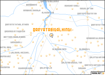
Qaryat ‘Abīd al Hindī (Bābil, Iraq)Qaryat ‘Abīd al Hindī is a town in the Bābil region of Iraq. An overview map of the region around Qaryat ‘Abīd al Hindī is displayed below.
regional and 3d topo map of Qaryat ‘Abīd al Hindī, Iraq ::
Nearby towns ::
Kāz̧im Muḩaymīd (1.7km east) //
Awlād Kāz̧im (2.2km south east) //
Saddat al Hindīyah (2.3km west) //
Qaryat Adhām Ḩamzah (2.9km south) //
Shaykh Ghannām (3.1km north east) //
Rashīd (2.9km east) //
Ālbū Su‘ūd (3.5km north) //
‘Abbās Kāz̧im (3.0km east) //
Qaryat Zawīyah (3.3km south west) //
‘Arab ‘Alī Mukhaylif (3.9km south east) //
‘Arab Muḩammad al ‘Allūsh (4.0km north east) //
‘Arab ‘Alī an Nāhī (4.0km north east) //
Qal‘at al ‘Abd Allāh (4.6km north) //
Sayyid ‘Az̧īm (4.3km north west) //
Sayyid (4.4km south west) //
Al Afandīyah (5.0km north) //
Qaryat ‘Abbūd Siţār (4.7km south east) //
‘Abbās (4.9km east) //
Ālbū Muşţafá (5.7km south east) //
Qal‘at Ţāmī as Salmān (6.2km south) //
Qaryat ar Rumaylah (6.4km south) //
‘Abbās al ‘Abd Allāh (6.7km north) //
Shāfī (6.8km south) //
Qal‘at ‘Abbās az̧ Z̧āhir (6.0km east) //
Qaryat al Jazzārah (6.9km north west) //
Qaryat al Birkah (6.1km west) //
‘Ayn an Namlah (6.5km north east) //
Anhad (6.5km north east) //
‘Imrān (6.5km north east) //
[all distances 'as the bird flies' and approximate] 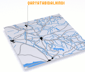 Places with similar names to Qaryat ‘Abīd al Hindī, Iraq :: Disclaimer :: Information on this page comes without warranty of any kind |
||
|
Where is Qaryat ‘Abīd al Hindī? Elevation and coordinates ::
Latitude (lat): 32°42'31"N Longitude (lon): 44°18'12"E
Elevation (approx.): 35m (map arrows pan, magnifying glasses zoom) |
||
|
Visiting Qaryat ‘Abīd al Hindī? Hotel/Accommodation ::
Book a hotel in Qaryat ‘Abīd al Hindī Travel Guide ::
Buy a travel guide for Iraq rental cars ::
car rental offers GPS waypoint ::
download a GPX waypoint (PoI) of Qaryat ‘Abīd al Hindī for your GPS receiver
|
||