|
search place name
|
||
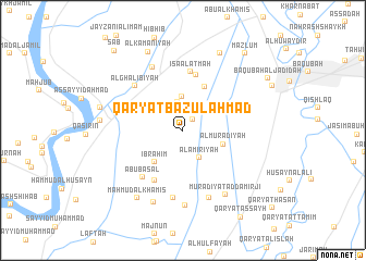
Qaryat Bāzūl Aḩmad (Diyālá, Iraq)Qaryat Bāzūl Aḩmad is a town in the Diyālá region of Iraq. An overview map of the region around Qaryat Bāzūl Aḩmad is displayed below.
regional and 3d topo map of Qaryat Bāzūl Aḩmad, Iraq ::
Nearby towns ::
Murādīyah (1.4km north east) //
Ayār al Kāz̧im (2.5km north) //
Qaryat al Hāshimīyah (2.9km north) //
Al Amīrīyah (3.2km south east) //
Qaryat al ‘Abbārah (3.4km north) //
Ibrāhīm (4.0km south west) //
Al Murādīyah (3.7km east) //
Az̧ Z̧ābiţīyah (4.9km north east) //
Bāzūl Sa‘dān (5.6km south west) //
Qaryat al ‘Urūbah (5.8km north) //
‘Īsá al ‘Atmah (6.1km north) //
Abū Başal (5.9km south west) //
Al Ghālibīyah (6.1km north west) //
Nā‘ūr (5.9km north west) //
Bāzūl Abū Kidīsh (7.0km south) //
Al Luqmānīyah (7.0km north) //
Qal‘at Rāghib Afandī (7.3km south) //
Qaryat al Maḩbūbīyah (7.7km south) //
Murādīyat ad Dāmirjī (7.5km south east) //
Ḩusayn al Muşţafá (7.8km south) //
Maḩmūd al Khamīs (8.0km south west) //
Dukhaylā (7.2km west) //
Marāsimah (7.4km west) //
Al Ḩudayd (8.5km north) //
Al Kamanīyah (8.6km north) //
Maz̧lūm (9.5km north east) //
Ba‘qūbah al Jadīdah (9.0km north east) //
Sab‘ (10.1km north west) //
[all distances 'as the bird flies' and approximate]  Places with similar names to Qaryat Bāzūl Aḩmad, Iraq :: Disclaimer :: Information on this page comes without warranty of any kind |
||
|
Where is Qaryat Bāzūl Aḩmad? Elevation and coordinates ::
Latitude (lat): 33°41'45"N Longitude (lon): 44°31'33"E
Elevation (approx.): 42m (map arrows pan, magnifying glasses zoom) |
||
|
Visiting Qaryat Bāzūl Aḩmad? Hotel/Accommodation ::
Book a hotel in Qaryat Bāzūl Aḩmad Travel Guide ::
Buy a travel guide for Iraq rental cars ::
car rental offers GPS waypoint ::
download a GPX waypoint (PoI) of Qaryat Bāzūl Aḩmad for your GPS receiver
|
||