|
search place name
|
||
Qaryat Ḩasan (Diyālá, Iraq)Qaryat Ḩasan is a town in the Diyālá region of Iraq. An overview map of the region around Qaryat Ḩasan is displayed below.
regional and 3d topo map of Qaryat Ḩasan, Iraq ::

Nearby towns ::
Qaryat Ḩalīm (1.9km north) //
Qaryat ‘Abd Allāh al Aḩmad (2.3km south) //
Qaryat at Taʼmīm (2.4km south east) //
Ḩusayn al ‘Alī (3.2km north east) //
Qaryat as Sayḩ (2.9km west) //
Qaryat al Işlāḩ (4.1km south) //
Imām Ways (4.4km north east) //
Murādīyat ad Dāmirjī (4.3km west) //
Qaryat an Naqīb (5.2km south) //
Qal‘at Rāghib Afandī (5.5km west) //
Jarīmah (6.2km south east) //
Imām Abū Khamīs (5.7km east) //
Al Ḩulfāyah (7.0km south west) //
Al Murādīyah (7.7km north west) //
‘Arab al Ḩusaynīyah (8.7km south) //
Al Amīrīyah (8.1km north west) //
Jum‘ah (8.4km north east) //
Khān Banī Sa‘d (9.0km south west) //
Jāsim Abū Ḩabbah (10.4km north east) //
Qaryat ar Rabī‘ (10.6km south west) //
Qaryat az Zubūr (11.1km south west) //
[all distances 'as the bird flies' and approximate] 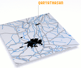 Places with similar names to Qaryat Ḩasan, Iraq :: Disclaimer :: Information on this page comes without warranty of any kind |
||
|
Where is Qaryat Ḩasan? Elevation and coordinates ::
Latitude (lat): 33°37'28"N Longitude (lon): 44°36'30"E
Elevation (approx.): 46m (map arrows pan, magnifying glasses zoom) |
||
|
Visiting Qaryat Ḩasan? Hotel/Accommodation ::
Book a hotel in Qaryat Ḩasan Travel Guide ::
Buy a travel guide for Iraq rental cars ::
car rental offers GPS waypoint ::
download a GPX waypoint (PoI) of Qaryat Ḩasan for your GPS receiver
|
||