|
search place name
|
||
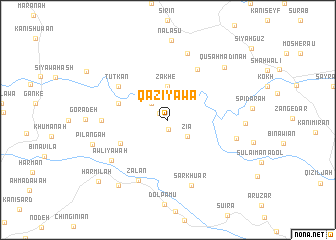
Qaziyāwa (As Sulaymānīyah, Iraq)Qaziyāwa is a town in the As Sulaymānīyah region of Iraq. An overview map of the region around Qaziyāwa is displayed below.
regional and 3d topo map of Qaziyāwa, Iraq ::
Qaziyāwa airports ::
The nearest airport is SDG - Sanandaj, located 129.2 km south east of Qaziyāwa.
Other airports nearby include KSH - Bakhtaran Shahid Ashrafi Esfahani (202.5 km south east), Nearby towns ::
Kānī Bān (1.1km south) //
Daigala (1.0km north west) //
Pīrmān (2.4km north west) //
Zīa (2.5km south east) //
Zākhe (3.7km north) //
Āshi Bārām (4.9km west) //
Māmā Qālān (5.0km south west) //
Norik (6.3km north east) //
Tūtkān (5.8km north west) //
Bozān (6.0km west) //
Zalan (7.3km south) //
Būskān (7.6km north) //
Sar Khuar (7.6km south) //
Awliyāwah (6.8km south west) //
Shaykh al Mārayn (6.6km east) //
Chamak (7.0km east) //
Qūsah Madīnah (7.8km north east) //
Pilangah (7.3km west) //
Nalasu (8.8km north) //
Hawlū (8.6km south west) //
Harmilah (9.3km south west) //
[all distances 'as the bird flies' and approximate] 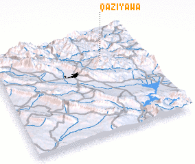 Places with similar names to Qaziyāwa, Iraq :: Disclaimer :: Information on this page comes without warranty of any kind |
||
|
Where is Qaziyāwa? Elevation and coordinates ::
Latitude (lat): 35°44'0"N Longitude (lon): 45°43'0"E
Elevation (approx.): 1119m (map arrows pan, magnifying glasses zoom) |
||
|
Visiting Qaziyāwa? Hotel/Accommodation ::
Book a hotel in Qaziyāwa Travel Guide ::
Buy a travel guide for Iraq rental cars ::
car rental offers GPS waypoint ::
download a GPX waypoint (PoI) of Qaziyāwa for your GPS receiver
|
||