|
search place name
|
||
Sabz Būlāq (Diyālá, Iraq)Sabz Būlāq is a town in the Diyālá region of Iraq. An overview map of the region around Sabz Būlāq is displayed below.
regional and 3d topo map of Sabz Būlāq, Iraq ::

Sabz Būlāq airports ::
The nearest airport is KSH - Bakhtaran Shahid Ashrafi Esfahani, located 166.9 km east of Sabz Būlāq.
Other airports nearby include SDG - Sanandaj (173.7 km north east), Nearby towns ::
Mūsá ‘Uthmān (2.2km south) //
Tāzādī (2.4km south west) //
Mullā Ḩasan (2.4km south east) //
Ḩusayn Ismā‘īl Āghā (2.4km north east) //
Dārah Khurmā (2.4km north east) //
Awī Ḩāḑir (4.6km south) //
Ghaydān (3.9km west) //
Gākūl (4.9km north west) //
Khalīfah Murād (4.8km north east) //
‘Alī Shāfī (4.8km north west) //
Dārah Khurmah aş Şaghīrah (4.6km east) //
Shawkat Bak (5.8km south) //
‘Abd Allāh Bayk (5.8km south) //
Sayyid (5.7km south) //
Sayyid ‘Alī (4.9km west) //
Ţāzah Shahr (5.3km north west) //
Sharawand ‘Abd Allāh Āghā (7.3km north west) //
‘Abd Allāh (7.2km north west) //
Ash Shaykh Chalabī (8.0km south) //
Ţūb ‘Askar (8.2km north) //
Imām Bābā Maḩmūd (8.5km south) //
Amarau (9.6km south east) //
[all distances 'as the bird flies' and approximate] 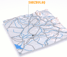 Places with similar names to Sabz Būlāq, Iraq :: Disclaimer :: Information on this page comes without warranty of any kind |
||
|
Where is Sabz Būlāq? Elevation and coordinates ::
Latitude (lat): 34°29'0"N Longitude (lon): 45°21'0"E
Elevation (approx.): 203m (map arrows pan, magnifying glasses zoom) |
||
|
Visiting Sabz Būlāq? Hotel/Accommodation ::
Book a hotel in Sabz Būlāq Travel Guide ::
Buy a travel guide for Iraq rental cars ::
car rental offers GPS waypoint ::
download a GPX waypoint (PoI) of Sabz Būlāq for your GPS receiver
|
||