|
search place name
|
||
Sará Jāwa (As Sulaymānīyah, Iraq)Sará Jāwa is a town in the As Sulaymānīyah region of Iraq. An overview map of the region around Sará Jāwa is displayed below.
regional and 3d topo map of Sará Jāwa, Iraq ::

Sará Jāwa airports ::
The nearest airport is TBZ - Tabriz Intl, located 244.5 km north east of Sará Jāwa.
Nearby towns ::
Qūmāwān (0.3km north) //
Tirshāwa (1.0km south) //
Darmānāwa (2.3km south east) //
Bānamān (2.4km south west) //
Girdikhwādāw (4.4km south) //
Kifradōl (4.8km south) //
Pūka-i Khwārū (5.0km south) //
Shīkārta (4.6km north west) //
Karam Kadāl (4.2km east) //
Angōz (5.3km north) //
Qurabarāza (5.5km south) //
Khalīfān (5.2km south west) //
Astērīlān (5.1km south east) //
Chamiyāwā (5.4km south west) //
Mīrah Bak (5.2km east) //
Boliqina (6.0km north east) //
Bard Hushtir (6.0km north east) //
Pāshkōtal (6.2km north east) //
Tōpzāwa (6.6km north east) //
Zingzinga (7.0km south) //
Rēzīna (6.1km north east) //
Qalah Saydah (7.2km north) //
Mīkūkah (6.4km north east) //
Bardakhira (6.1km east) //
Sirkīkān (6.1km east) //
Kānī Bināw (7.3km north east) //
Bēlinga (6.2km west) //
Āmānj (7.5km north west) //
Nūrah (8.3km north) //
[all distances 'as the bird flies' and approximate] 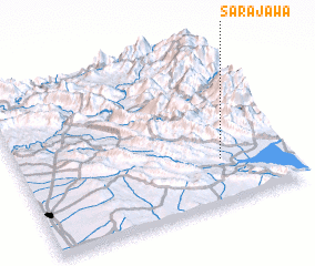 Places with similar names to Sará Jāwa, Iraq :: Disclaimer :: Information on this page comes without warranty of any kind |
||
|
Where is Sará Jāwa? Elevation and coordinates ::
Latitude (lat): 36°16'32"N Longitude (lon): 44°45'22"E
Elevation (approx.): 578m (map arrows pan, magnifying glasses zoom) |
||
|
Visiting Sará Jāwa? Hotel/Accommodation ::
Book a hotel in Sará Jāwa Travel Guide ::
Buy a travel guide for Iraq rental cars ::
car rental offers GPS waypoint ::
download a GPX waypoint (PoI) of Sará Jāwa for your GPS receiver
|
||