|
search place name
|
||
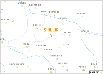
Shillia (Dahūk, Iraq)Shillia is a town in the Dahūk region of Iraq. An overview map of the region around Shillia is displayed below.
regional and 3d topo map of Shillia, Iraq ::
Shillia airports ::
The nearest airport is VAN - Van, located 177.5 km north of Shillia.
Nearby towns ::
Billān (4.4km south east) //
Harmāshī (5.0km south west) //
Rakāwah (5.7km south) //
Rabatkī (5.3km north west) //
Bēbātki (5.7km north east) //
Bayrkāt (5.0km east) //
Tillān (5.8km south east) //
Kānī Māzī (6.6km north east) //
Chamānkī (8.0km north) //
Naychirvān (8.0km south) //
Meize (8.3km north) //
Atrūsh (8.0km south west) //
[all distances 'as the bird flies' and approximate] 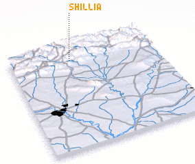 Places with similar names to Shillia, Iraq ::
Disclaimer :: Information on this page comes without warranty of any kind |
||
|
Where is Shillia? Elevation and coordinates ::
Latitude (lat): 36°52'14"N Longitude (lon): 43°24'56"E
Elevation (approx.): 1129m (map arrows pan, magnifying glasses zoom) |
||
|
Visiting Shillia? Hotel/Accommodation ::
Book a hotel in Shillia Travel Guide ::
Buy a travel guide for Iraq rental cars ::
car rental offers GPS waypoint ::
download a GPX waypoint (PoI) of Shillia for your GPS receiver
|
||