|
search place name
|
||
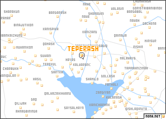
Tepe Rash (As Sulaymānīyah, Iraq)Tepe Rash is a town in the As Sulaymānīyah region of Iraq. An overview map of the region around Tepe Rash is displayed below.
regional and 3d topo map of Tepe Rash, Iraq ::
Tepe Rash airports ::
The nearest airport is SDG - Sanandaj, located 105.2 km east of Tepe Rash.
Other airports nearby include KSH - Bakhtaran Shahid Ashrafi Esfahani (162.2 km south east), Nearby towns ::
Sayyid Şādiq (2.0km north) //
Kalwarān[2] (2.1km south) //
Kalwarān[1] (2.2km east) //
Qallirkh (2.4km north west) //
Zongāw-i Sayyid Sādiq (2.6km north east) //
Tazadi (2.9km south) //
Hayas (2.5km west) //
Sölamish-i Khwārū (2.9km south west) //
Serān (3.6km north west) //
Bairashga (3.6km south east) //
Qōmāsh-i Khwārū (4.1km south west) //
Hājī Nāmiq (4.6km north east) //
Nāogirdan (4.2km south east) //
Qāmīsh Tepe (4.2km east) //
Kānī Zard (5.5km north) //
Shamilo (5.5km south) //
Mastakān (5.4km east) //
Sārtka (6.1km south west) //
Qōmāsh-i Zhūrū (5.9km west) //
Dollash (6.5km south east) //
Mastakān-i Zhūrū (6.1km east) //
Girdanāzī (6.2km east) //
Qarah Tappah (6.5km south east) //
Tepe Kul (6.5km west) //
Qōmāsh (6.8km west) //
Suwārī (6.9km west) //
Nawē (8.8km north) //
Kachālī (8.9km north) //
Faţh ‘Alī (8.3km south east) //
[all distances 'as the bird flies' and approximate] 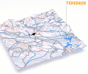 Places with similar names to Tepe Rash, Iraq ::
Disclaimer :: Information on this page comes without warranty of any kind |
||
|
Where is Tepe Rash? Elevation and coordinates ::
Latitude (lat): 35°20'31"N Longitude (lon): 45°51'33"E
Elevation (approx.): 501m (map arrows pan, magnifying glasses zoom) |
||
|
Visiting Tepe Rash? Hotel/Accommodation ::
Book a hotel in Tepe Rash Travel Guide ::
Buy a travel guide for Iraq rental cars ::
car rental offers GPS waypoint ::
download a GPX waypoint (PoI) of Tepe Rash for your GPS receiver
|
||