|
search place name
|
||
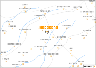
Umaragada (At Taʼmīm, Iraq)Umaragada is a town in the At Taʼmīm region of Iraq. An overview map of the region around Umaragada is displayed below.
regional and 3d topo map of Umaragada, Iraq ::
Nearby towns ::
Umaragada (0.0km north) //
Taymabāwah (2.0km south east) //
Shaykh Jigrī (2.4km north west) //
MīrānSurah (3.2km south) //
Shir Darra (4.8km south east) //
‘Uthmān Lākah (6.3km south) //
Hanārah (6.3km south east) //
Bāsh Būlāq (6.9km north west) //
Qāra Wāis (6.4km east) //
Bāsh Būlāq (8.1km north) //
Kutabān (7.2km east) //
Haftah Chashmah (8.8km south) //
Shūwānah (8.0km south west) //
Takīyah (10.5km south east) //
Qarah Anjīr (11.0km north west) //
[all distances 'as the bird flies' and approximate]  Places with similar names to Umaragada, Iraq ::
Disclaimer :: Information on this page comes without warranty of any kind |
||
|
Where is Umaragada? Elevation and coordinates ::
Latitude (lat): 35°24'45"N Longitude (lon): 44°42'43"E
Elevation (approx.): 784m (map arrows pan, magnifying glasses zoom) |
||
|
Visiting Umaragada? Hotel/Accommodation ::
Book a hotel in Umaragada Travel Guide ::
Buy a travel guide for Iraq rental cars ::
car rental offers GPS waypoint ::
download a GPX waypoint (PoI) of Umaragada for your GPS receiver
|
||