|
search place name
|
||
‘Umar Bal (Diyālá, Iraq)‘Umar Bal is a town in the Diyālá region of Iraq. An overview map of the region around ‘Umar Bal is displayed below.
regional and 3d topo map of ‘Umar Bal, Iraq ::
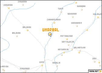
Nearby towns ::
Chahār Shākh (5.2km north) //
Fattāḩ ‘Umar (4.9km east) //
Sayyid Jaznī (6.1km south east) //
Ḩaydar Kāl (7.0km south east) //
Ibrāhim Khān (7.5km south east) //
Balakah (7.4km west) //
Sar Qal‘ah (8.0km south east) //
Sekhīrān (9.7km north east) //
[all distances 'as the bird flies' and approximate] 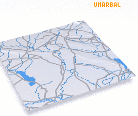 Places with similar names to ‘Umar Bal, Iraq ::
// Umaro Bela (GW)
Disclaimer :: Information on this page comes without warranty of any kind |
||
|
Where is ‘Umar Bal? Elevation and coordinates ::
Latitude (lat): 34°47'9"N Longitude (lon): 44°59'26"E
Elevation (approx.): 332m (map arrows pan, magnifying glasses zoom) |
||
|
Visiting ‘Umar Bal? Hotel/Accommodation ::
Book a hotel in ‘Umar Bal Travel Guide ::
Buy a travel guide for Iraq rental cars ::
car rental offers GPS waypoint ::
download a GPX waypoint (PoI) of ‘Umar Bal for your GPS receiver
|
||