|
search place name
|
||
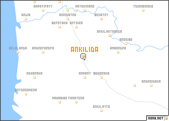
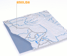
Ankilida (Mahajanga, Madagascar)Ankilida is a town in the Mahajanga region of Madagascar. An overview map of the region around Ankilida is displayed below.
regional and 3d topo map of Ankilida, Madagascar ::
Ankilida airports ::
The nearest airport is BPY - Besalampy, located 177.1 km north of Ankilida.
Other airports nearby include ZVA - Miandrivazo (192.0 km south east), MOQ - Morondava (218.3 km south), Nearby towns ::
 Places with similar names to Ankilida, Madagascar ::
// Anclote (US)
// Angulito (PA)
// Ankilidahy (MG)
// Aneuk Laot (ID)
// Angoleta (VE)
// Anacleto (MZ)
// Anglade (HT)
// Anglet (FR)
// Anglade (FR)
// Anglade (FR)
Disclaimer :: Information on this page comes without warranty of any kind |
||
|
Where is Ankilida? Elevation and coordinates ::
Latitude (lat): 18°19'0"S Longitude (lon): 44°11'0"E
Elevation (approx.): 48m (map arrows pan, magnifying glasses zoom) |
||
|
Visiting Ankilida? Hotel/Accommodation ::
Book a hotel in Ankilida Travel Guide ::
Buy a travel guide for Madagascar rental cars ::
car rental offers GPS waypoint ::
download a GPX waypoint (PoI) of Ankilida for your GPS receiver
|
||