|
search place name
|
||
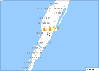
Ilampy (Toamasina, Madagascar)Ilampy is a town in the Toamasina region of Madagascar. An overview map of the region around Ilampy is displayed below.
regional and 3d topo map of Ilampy, Madagascar ::
Ilampy airports ::
The nearest airport is SMS - Sainte Marie, located 14.2 km south west of Ilampy.
Other airports nearby include WMR - Mananara Avaratra (91.4 km north), TMM - Toamasina (135.1 km south), WMN - Maroantsetra (172.4 km north), ANM - Antalaha Antsirabato (224.5 km north), Nearby towns ::
Marosoroka (2.6km north west) //
Berona (2.6km south west) //
Anjahamara (2.6km south west) //
Tanambao (2.6km north east) //
Ambodifotatra (3.5km west) //
Sahabe (3.5km west) //
Maromandia (3.7km north) //
Sahamanora (4.1km north west) //
Manandroandro (4.1km north east) //
Lohatrozona (4.1km north east) //
Ambohitsara (4.1km south west) //
Ankoalabe (5.8km north) //
Ankabahoba (5.8km north) //
Ankoalamare (6.6km south west) //
Ambodiforaha (6.6km south west) //
Ikoa (6.5km south west) //
Mahavelo (7.7km south west) //
Fitariha (8.2km north east) //
Andapanangoy (9.1km south west) //
[all distances 'as the bird flies' and approximate] 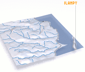
Disclaimer :: Information on this page comes without warranty of any kind |
||
|
Where is Ilampy? Elevation and coordinates ::
Latitude (lat): 16°59'0"S Longitude (lon): 49°53'0"E
Elevation (approx.): 36m (map arrows pan, magnifying glasses zoom) |
||
|
Visiting Ilampy? Hotel/Accommodation ::
Book a hotel in Ilampy Travel Guide ::
Buy a travel guide for Madagascar rental cars ::
car rental offers GPS waypoint ::
download a GPX waypoint (PoI) of Ilampy for your GPS receiver
|
||