|
search place name
|
||
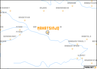
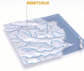
Mahatsinjo (Toamasina, Madagascar)Mahatsinjo is a town in the Toamasina region of Madagascar. An overview map of the region around Mahatsinjo is displayed below.
regional and 3d topo map of Mahatsinjo, Madagascar ::
Mahatsinjo airports ::
The nearest airport is WMR - Mananara Avaratra, located 45.3 km east of Mahatsinjo.
Other airports nearby include WMN - Maroantsetra (88.5 km north east), SMS - Sainte Marie (114.0 km south east), ANM - Antalaha Antsirabato (165.9 km north east), ZWA - Andapa (170.1 km north), Nearby towns ::
 Places with similar names to Mahatsinjo, Madagascar ::
// Mahatsinje (MG)
// Mahatsinjo (MG)
// Mahatsinjo (MG)
// Mahatsinjo (MG)
// Mahatsinjo (MG)
// Mahatsinjo (MG)
// Mahatsinjo (MG)
// Mahatsinjo (MG)
// Mahatsinjo (MG)
// Mahatsinjo (MG)
Disclaimer :: Information on this page comes without warranty of any kind |
||
|
Where is Mahatsinjo? Elevation and coordinates ::
Latitude (lat): 16°10'0"S Longitude (lon): 49°21'0"E
Elevation (approx.): 615m (map arrows pan, magnifying glasses zoom) |
||
|
Visiting Mahatsinjo? Hotel/Accommodation ::
Book a hotel in Mahatsinjo Travel Guide ::
Buy a travel guide for Madagascar rental cars ::
car rental offers GPS waypoint ::
download a GPX waypoint (PoI) of Mahatsinjo for your GPS receiver
|
||