|
search place name
|
||
Mangarano (Antananarivo, Madagascar)Mangarano is a town in the Antananarivo region of Madagascar. An overview map of the region around Mangarano is displayed below.
regional and 3d topo map of Mangarano, Madagascar ::

Mangarano airports ::
The nearest airport is TNR - Antananarivo Ivato, located 39.8 km south east of Mangarano.
Other airports nearby include ZVA - Miandrivazo (224.5 km south west), Nearby towns ::
Fonohasina (2.6km north west) //
Mahavelona (2.6km south west) //
Ambohibeloma (4.0km north east) //
Sahapetraka (5.1km south east) //
Merikanjaka (5.6km south) //
Antongombato (5.3km west) //
Mananjary (6.4km south east) //
Mahajambakisoa (6.4km south east) //
Soaniadanana (7.3km west) //
Manazary (7.6km north) //
Filomana (8.2km north east) //
Antanetikely (8.2km north west) //
Antsahalava (9.0km south east) //
Ambohitrafovoany (9.0km north east) //
Ambatoharanana (9.0km south west) //
[all distances 'as the bird flies' and approximate] 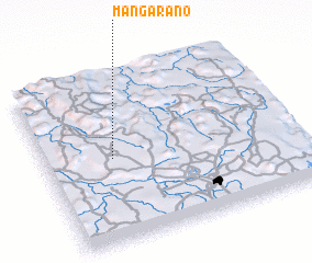 Places with similar names to Mangarano, Madagascar ::
// Mankrin (MM)
// Mangarin (PH)
// Manguirin (PH)
// Monkey Run (US)
// Munggu Ruan (MY)
// Mingarine (IT)
// Mayñgaran (PH)
// Măngureni (RO)
// Mangarano (MG)
// Mangarano (MG)
Disclaimer :: Information on this page comes without warranty of any kind |
||
|
Where is Mangarano? Elevation and coordinates ::
Latitude (lat): 18°30'0"S Longitude (lon): 47°16'0"E
Elevation (approx.): 1296m (map arrows pan, magnifying glasses zoom) |
||
|
Visiting Mangarano? Hotel/Accommodation ::
Book a hotel in Mangarano Travel Guide ::
Buy a travel guide for Madagascar rental cars ::
car rental offers GPS waypoint ::
download a GPX waypoint (PoI) of Mangarano for your GPS receiver
|
||