|
search place name
|
||
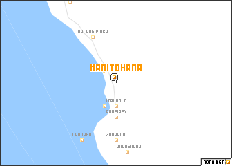
Manitohana (Toliara, Madagascar)Manitohana is a town in the Toliara region of Madagascar. An overview map of the region around Manitohana is displayed below.
regional and 3d topo map of Manitohana, Madagascar ::
Manitohana airports ::
The nearest airport is TLE - Toliara, located 142.1 km north of Manitohana.
Nearby towns ::
Lavavolo (2.5km north west) //
Itampolo (3.7km south) //
Berobontsy (4.1km south west) //
Anafiafy (5.6km south) //
Malangiriaka (8.1km north west) //
[all distances 'as the bird flies' and approximate]  Places with similar names to Manitohana, Madagascar ::
// Mandahan (MY)
// Manitohany (MG)
// Mandhān (IN)
// Māndhan (IN)
// Mandhon (PK)
// Mana de Haina (DO)
// Montahon (FR)
// Mandahun (SL)
// Mandehun (SL)
// Mindohun (SL)
Disclaimer :: Information on this page comes without warranty of any kind |
||
|
Where is Manitohana? Elevation and coordinates ::
Latitude (lat): 24°39'0"S Longitude (lon): 43°57'0"E
Elevation (approx.): 17m (map arrows pan, magnifying glasses zoom) |
||
|
Visiting Manitohana? Hotel/Accommodation ::
Book a hotel in Manitohana Travel Guide ::
Buy a travel guide for Madagascar rental cars ::
car rental offers GPS waypoint ::
download a GPX waypoint (PoI) of Manitohana for your GPS receiver
|
||