|
search place name
|
||
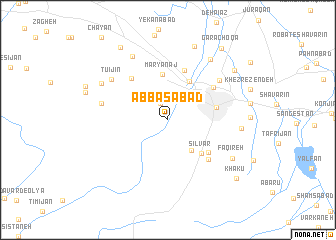
‘Abbāsābād (Hamadān, Iran)‘Abbāsābād is a town in the Hamadān region of Iran. An overview map of the region around ‘Abbāsābād is displayed below.
regional and 3d topo map of ‘Abbāsābād, Iran ::
‘Abbāsābād airports ::
The nearest airport is KSH - Bakhtaran Shahid Ashrafi Esfahani, located 129.5 km west of ‘Abbāsābād.
Other airports nearby include SDG - Sanandaj (142.6 km west), Nearby towns ::
Ḩeydareh-ye Posht-e Shahr (2.0km north) //
Cheshmeh Malek (4.0km south east) //
Manūchehrī (4.8km north east) //
Maryānaj (5.2km north) //
Sīlvār (4.8km south east) //
Hamadān (4.7km east) //
Darreh Morād Beyg (5.2km south east) //
Dīzaj (5.8km north) //
Selūlān (5.7km north west) //
Ḩeşar (5.5km north east) //
Sīlvār (5.8km south east) //
Ḩesār-e Dīzaj (6.5km north east) //
Daftarchīn (6.4km west) //
Tūʼī Jīn (6.8km north west) //
Ūznān (7.8km north west) //
Ḩeşār-e Āqā Shams ‘Alī (6.8km east) //
‘Alīābād-e Posht-e Shahr (7.8km north east) //
Faqīreh (7.3km south east) //
Hūʼī Jīn (7.4km north west) //
Anşār ol Emām (8.5km north) //
Qāsemābād (8.2km north east) //
Cheshmeh Qaşşābān (9.1km north west) //
Garā Choqā (9.4km north east) //
Khākū (9.1km south east) //
[all distances 'as the bird flies' and approximate] 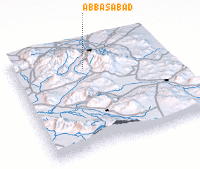 Places with similar names to ‘Abbāsābād, Iran ::
// 'Abāsābād (IR)
// Abbāsābād (IR)
// Abbāsābād (IR)
// Abbāsābād (IR)
// Abū Zabad (SD)
// Abbāsābād (PK)
// ‘Abbāsābād (IR)
// ‘Abas̄ābād (IR)
// ‘Abāsābād (IR)
// ‘Abbasābād (IR)
Disclaimer :: Information on this page comes without warranty of any kind |
||
|
Where is ‘Abbāsābād? Elevation and coordinates ::
Latitude (lat): 34°47'0"N Longitude (lon): 48°28'0"E
Elevation (approx.): 1955m (map arrows pan, magnifying glasses zoom) |
||
|
Visiting ‘Abbāsābād? Hotel/Accommodation ::
Book a hotel in ‘Abbāsābād Travel Guide ::
Buy a travel guide for Iran rental cars ::
car rental offers GPS waypoint ::
download a GPX waypoint (PoI) of ‘Abbāsābād for your GPS receiver
|
||