|
search place name
|
||
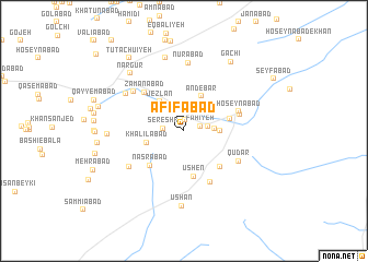
‘Afīfābād (Eşfahān, Iran)‘Afīfābād is a town in the Eşfahān region of Iran. An overview map of the region around ‘Afīfābād is displayed below.
regional and 3d topo map of ‘Afīfābād, Iran ::
‘Afīfābād airports ::
The nearest airport is AZD - Yazd Shahid Sadooghi, located 153.2 km south east of ‘Afīfābād.
Nearby towns ::
Sefīdeh (0.6km north west) //
‘Anīfābād (1.1km north) //
Fahīyeh (1.5km east) //
Sereshk (1.8km west) //
Ḩājjīābād (2.2km north west) //
‘Eshratābād (2.2km east) //
Māngī-ye Bālā (2.5km north west) //
Mazra‘ehcheh (2.6km east) //
Qolīābād (3.1km north west) //
Qal‘eh-ye Ḩājjīābād (3.1km east) //
Jezlān (3.7km north west) //
‘Andebar (3.8km north east) //
Khalīlābād (3.4km west) //
Ūshen (4.7km south) //
Allāhābād (4.2km east) //
Naşrābād (4.6km south west) //
Fūdāz (4.8km south east) //
Zamānābād (5.2km north west) //
Ḩoseynābād (5.1km north east) //
Hāshemābād (5.8km south east) //
Fūdāz (5.1km east) //
Qūdār (5.6km south east) //
Lāghareh (5.9km north west) //
Masīr-e Ḩājj (5.9km south west) //
Nūrābād (7.0km north) //
Jeznābād (6.2km north west) //
Dowlatābād (7.6km north) //
Ūshan (7.7km south) //
Yūsofābād (6.6km west) //
[all distances 'as the bird flies' and approximate] 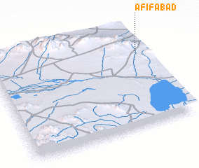 Places with similar names to ‘Afīfābād, Iran :: Disclaimer :: Information on this page comes without warranty of any kind |
||
|
Where is ‘Afīfābād? Elevation and coordinates ::
Latitude (lat): 32°41'0"N Longitude (lon): 52°56'0"E
Elevation (approx.): 2099m (map arrows pan, magnifying glasses zoom) |
||
|
Visiting ‘Afīfābād? Hotel/Accommodation ::
Book a hotel in ‘Afīfābād Travel Guide ::
Buy a travel guide for Iran rental cars ::
car rental offers GPS waypoint ::
download a GPX waypoint (PoI) of ‘Afīfābād for your GPS receiver
|
||