|
search place name
|
||
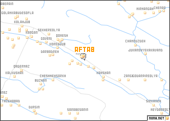
Āftāb (Īlām, Iran)Āftāb is a town in the Īlām region of Iran. An overview map of the region around Āftāb is displayed below.
regional and 3d topo map of Āftāb, Iran ::
Āftāb airports ::
The nearest airport is KSH - Bakhtaran Shahid Ashrafi Esfahani, located 39.3 km north west of Āftāb.
Other airports nearby include SDG - Sanandaj (138.9 km north), Nearby towns ::
Rīkhel (1.0km north west) //
Zabţakīn (1.1km south west) //
Ābţāf (1.5km south east) //
Bāgh-e Yāsam (1.4km south west) //
Bānrīvand (2.4km south east) //
Sāmeleh-ye Soflá (2.4km west) //
Sāmeleh-ye ‘Olyā (2.9km west) //
Kahshān (5.0km south east) //
Kūl Āseh (5.5km south east) //
Koreh Jūb (5.7km north west) //
Qomesh (6.2km north west) //
Sarāb (6.2km north west) //
Cherāghābād (6.0km west) //
Sekher-e Soflá (6.7km north west) //
Dārbadreh (6.5km west) //
Cheshmeh Sorkh (7.3km south west) //
Gerdakān Dār (7.7km south east) //
Govenī (8.1km north west) //
Sekher-e ‘Olyā (8.8km north west) //
[all distances 'as the bird flies' and approximate] 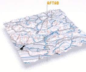 Places with similar names to Āftāb, Iran ::
Disclaimer :: Information on this page comes without warranty of any kind |
||
|
Where is Āftāb? Elevation and coordinates ::
Latitude (lat): 34°1'20"N Longitude (lon): 47°19'49"E
Elevation (approx.): 1635m (map arrows pan, magnifying glasses zoom) |
||
|
Visiting Āftāb? Hotel/Accommodation ::
Book a hotel in Āftāb Travel Guide ::
Buy a travel guide for Iran rental cars ::
car rental offers GPS waypoint ::
download a GPX waypoint (PoI) of Āftāb for your GPS receiver
|
||