|
search place name
|
||
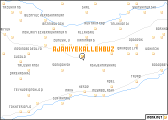
‘Ajamī-ye Kallehbūz (Ostān-e Āz̄arbāyjān-e Sharqī, Iran)‘Ajamī-ye Kallehbūz is a town in the Ostān-e Āz̄arbāyjān-e Sharqī region of Iran. An overview map of the region around ‘Ajamī-ye Kallehbūz is displayed below.
regional and 3d topo map of ‘Ajamī-ye Kallehbūz, Iran ::
‘Ajamī-ye Kallehbūz airports ::
The nearest airport is TBZ - Tabriz Intl, located 138.2 km north west of ‘Ajamī-ye Kallehbūz.
Nearby towns ::
Karīmābād (3.3km north) //
Khalīfeh Kamāl (4.1km north west) //
Āghjeh Mashhad (4.2km south east) //
Allāh Dād (5.2km north) //
Sārī Qamīsh (4.5km south west) //
Zereshlū (5.1km north west) //
Chekhmūr (5.1km east) //
Ḩeşār (7.1km south) //
Āgh Ţavaraq (7.3km north) //
Qezlejeh-ye Qeshlāq (8.1km south) //
Bārgāh (8.1km south) //
Mākh (8.2km south) //
‘Āqel (7.8km south east) //
Mūsá Bolāghī (8.6km south east) //
Zereshlū (7.6km north west) //
Beznī Bodāgh (8.8km north west) //
Mowlavī-ye Cherāgh Mardān (8.6km north west) //
Telīm Kandī (9.5km north east) //
Pīr Dāghī (9.5km north east) //
Qarah Qāch (10.9km north east) //
Beznī-ye Cherāgh Mardān (11.2km north west) //
[all distances 'as the bird flies' and approximate] 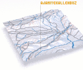 Places with similar names to ‘Ajamī-ye Kallehbūz, Iran :: Disclaimer :: Information on this page comes without warranty of any kind |
||
|
Where is ‘Ajamī-ye Kallehbūz? Elevation and coordinates ::
Latitude (lat): 37°15'14"N Longitude (lon): 47°20'39"E
Elevation (approx.): 1857m (map arrows pan, magnifying glasses zoom) |
||
|
Visiting ‘Ajamī-ye Kallehbūz? Hotel/Accommodation ::
Book a hotel in ‘Ajamī-ye Kallehbūz Travel Guide ::
Buy a travel guide for Iran rental cars ::
car rental offers GPS waypoint ::
download a GPX waypoint (PoI) of ‘Ajamī-ye Kallehbūz for your GPS receiver
|
||