|
search place name
|
||
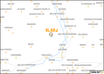
Alarj (Iran)Alarj is a town in Iran. An overview map of the region around Alarj is displayed below.
regional and 3d topo map of Alarj, Iran ::
Alarj airports ::
The nearest airport is THR - Teheran Mehrabad Intl, located 252.5 km north east of Alarj.
Nearby towns ::
Eskān (4.8km south east) //
Qal‘eh-ye Gāvgodār (4.6km east) //
Gūreh Zār (5.0km east) //
Jazanaq (6.4km south east) //
Mehr-e ‘Olyā (6.3km north east) //
Khosbījān (6.1km east) //
Far (7.3km south east) //
Qal‘eh-ye Azraj (7.6km north) //
Panjeh ‘Alī (7.6km south) //
Tūreh (7.6km south) //
Deh-e Shīrkhān (7.2km north east) //
Bādāmak (7.2km north west) //
Mehdīābād (8.0km south east) //
Ḩoseynābād (8.0km south east) //
Beşrī (7.3km south west) //
Mānīzān (8.3km north east) //
Gūsheh-ye ‘Olyā (8.7km north west) //
[all distances 'as the bird flies' and approximate]  Places with similar names to Alarj, Iran ::
Disclaimer :: Information on this page comes without warranty of any kind |
||
|
Where is Alarj? Elevation and coordinates ::
Latitude (lat): 34°7'0"N Longitude (lon): 49°19'0"E
Elevation (approx.): 1981m (map arrows pan, magnifying glasses zoom) |
||
|
Visiting Alarj? Hotel/Accommodation ::
Book a hotel in Alarj Travel Guide ::
Buy a travel guide for Iran rental cars ::
car rental offers GPS waypoint ::
download a GPX waypoint (PoI) of Alarj for your GPS receiver
|
||