|
search place name
|
||
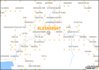
Ālesh Dasht (Gīlān, Iran)Ālesh Dasht is a town in the Gīlān region of Iran. An overview map of the region around Ālesh Dasht is displayed below.
regional and 3d topo map of Ālesh Dasht, Iran ::
Ālesh Dasht airports ::
The nearest airport is RAS - Rasht, located 53.3 km north of Ālesh Dasht.
Other airports nearby include RZR - Ramsar (103.9 km east), THR - Teheran Mehrabad Intl (206.5 km south east), Nearby towns ::
Neşfī (1.5km west) //
Kashān (1.5km west) //
Qāsem Ţāq (1.5km west) //
Neşfī (1.9km south) //
Jāzemkol (1.5km west) //
Khāşeh Kūl (2.4km south east) //
Kīābād (2.4km north east) //
Kalāyeh (2.4km south east) //
Kataleh-ye Shūshtehbar (2.4km north west) //
Shevashūy (2.4km south west) //
Tūtkābon (3.2km north) //
Pareh (3.0km east) //
Rūdābād (3.7km north) //
Anārkūl (3.0km east) //
Fīshom (3.0km west) //
Shūshteh Bar (3.0km west) //
Kharashk-e Bālā (4.0km north) //
Gāv Khas (4.0km north) //
Mūndeh Ābān (4.0km north) //
Sondos (3.5km north east) //
Kolūs Forūsh (3.5km south east) //
Fatalak (3.5km south west) //
Qatlak (3.5km south west) //
Solţānbarī (3.5km south west) //
Dasht-e Kūr (3.5km south west) //
Gortom (3.5km south west) //
Rostamābād (5.0km north) //
‘Alī Shārūd (4.7km south west) //
Tīm Shūshūy (4.7km south west) //
[all distances 'as the bird flies' and approximate]  Places with similar names to Ālesh Dasht, Iran :: Disclaimer :: Information on this page comes without warranty of any kind |
||
|
Where is Ālesh Dasht? Elevation and coordinates ::
Latitude (lat): 36°51'0"N Longitude (lon): 49°31'0"E
Elevation (approx.): 539m (map arrows pan, magnifying glasses zoom) |
||
|
Visiting Ālesh Dasht? Hotel/Accommodation ::
Book a hotel in Ālesh Dasht Travel Guide ::
Buy a travel guide for Iran rental cars ::
car rental offers GPS waypoint ::
download a GPX waypoint (PoI) of Ālesh Dasht for your GPS receiver
|
||