|
search place name
|
||
‘Alīābād-e Kenār Shahr (Golestān, Iran)‘Alīābād-e Kenār Shahr is a town in the Golestān region of Iran. An overview map of the region around ‘Alīābād-e Kenār Shahr is displayed below.
regional and 3d topo map of ‘Alīābād-e Kenār Shahr, Iran ::
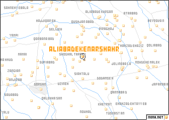
Nearby towns ::
Kamālābād (0.0km north) //
Ālūkalāteh (0.9km west) //
‘Alīābād (1.8km east) //
Shoghāl Tappeh (2.0km west) //
Rostam Kalāteh-ye Sādāt (2.6km south west) //
Solţānābād (3.0km north west) //
Rostam Kalāteh-ye Khāleşeh (3.2km north east) //
Ūjā Kūh (4.0km north) //
Sīāh Talū (4.2km south) //
Sarkhon Kalāteh (3.9km east) //
Rostam Kalā (4.2km east) //
Feyẕābād (5.1km south west) //
Now Deh-e Ḩājjī Sharīf (5.3km north) //
Jelīn-e Pā'īn (5.4km south) //
Valīkābād (4.9km south west) //
Chahār Chenār (5.5km north) //
Fūjerd (5.8km north) //
Khūjeh Tūp (5.8km north) //
Qorbān Moḩammad (5.2km north west) //
Qūjerd (5.0km west) //
Maryamābād (5.3km south west) //
Atrāchāl (5.1km west) //
Qāsemī Maḩalleh (6.5km north) //
Ḩeydarābād (6.3km north east) //
Fūjerd (5.4km west) //
Do Dāngeh (6.4km south east) //
Naşrābād (7.2km south) //
Qūshjānābād (7.3km north) //
Qal‘eh Jīq-e Moḩammad Āleq (7.6km north) //
[all distances 'as the bird flies' and approximate] 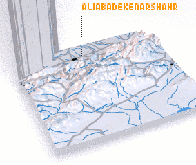 Places with similar names to ‘Alīābād-e Kenār Shahr, Iran :: Disclaimer :: Information on this page comes without warranty of any kind |
||
|
Where is ‘Alīābād-e Kenār Shahr? Elevation and coordinates ::
Latitude (lat): 36°53'53"N Longitude (lon): 54°31'21"E
Elevation (approx.): 47m (map arrows pan, magnifying glasses zoom) |
||
|
Visiting ‘Alīābād-e Kenār Shahr? Hotel/Accommodation ::
Book a hotel in ‘Alīābād-e Kenār Shahr Travel Guide ::
Buy a travel guide for Iran rental cars ::
car rental offers GPS waypoint ::
download a GPX waypoint (PoI) of ‘Alīābād-e Kenār Shahr for your GPS receiver
|
||