|
search place name
|
||
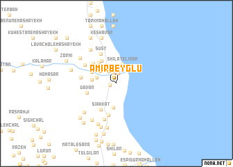
Amīr Beyglū (Gīlān, Iran)Amīr Beyglū is a town in the Gīlān region of Iran. An overview map of the region around Amīr Beyglū is displayed below.
regional and 3d topo map of Amīr Beyglū, Iran ::
Amīr Beyglū airports ::
The nearest airport is RAS - Rasht, located 92.0 km south east of Amīr Beyglū.
Other airports nearby include RZR - Ramsar (193.8 km south east), Nearby towns ::
Qal‘eh Bīn (0.9km west) //
Seyyed Lar (1.6km north) //
Qal‘eh Chīn Qadīm (1.8km north) //
Maḩmūdābād (2.1km north) //
Owtār (2.2km north west) //
Līsār Maḩalleh (3.0km north west) //
Līsār (2.8km north west) //
Shīlāt-e Līsār (3.2km north) //
Qal‘eh Dūsh (2.7km west) //
Namāzī Maḩalleh (3.4km north west) //
Qamayeh (3.8km south) //
Nowmandān (3.2km west) //
Ţāherī Maḩalleh (3.9km north west) //
Khūshāvar (4.1km north west) //
Hareh Dasht-e Shomālī (3.7km north west) //
Dīzgāh Maḩalleh (4.6km south west) //
Sīāhkat (4.6km south west) //
Agrī Bījār (4.4km north west) //
Dāvān (4.0km west) //
Qanbar Maḩalleh (5.1km south) //
Sūst (5.1km north west) //
Sīāh Ja‘far (4.6km west) //
Harah Dasht-e Jonūbī (4.9km north west) //
Kord Maḩalleh (5.9km south) //
Bābāsū-ye Khoţbeh Sarā (6.4km north west) //
Shafaqat Maḩalleh (6.2km south west) //
Sīāhkal (6.6km south west) //
Jowkandān (6.9km south) //
Peysarā (6.2km north west) //
[all distances 'as the bird flies' and approximate] 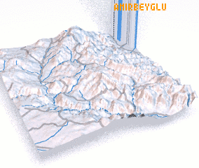 Places with similar names to Amīr Beyglū, Iran :: Disclaimer :: Information on this page comes without warranty of any kind |
||
|
Where is Amīr Beyglū? Elevation and coordinates ::
Latitude (lat): 37°57'3"N Longitude (lon): 48°55'17"E
Elevation (approx.): -12m (map arrows pan, magnifying glasses zoom) |
||
|
Visiting Amīr Beyglū? Hotel/Accommodation ::
Book a hotel in Amīr Beyglū Travel Guide ::
Buy a travel guide for Iran rental cars ::
car rental offers GPS waypoint ::
download a GPX waypoint (PoI) of Amīr Beyglū for your GPS receiver
|
||