|
search place name
|
||
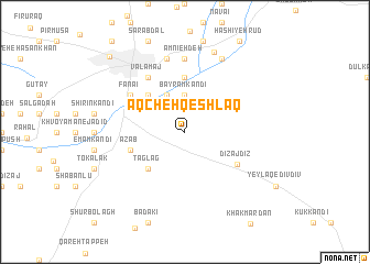
Āqcheh Qeshlāq (Ostān-e Āz̄arbāyjān-e Gharbī, Iran)Āqcheh Qeshlāq is a town in the Ostān-e Āz̄arbāyjān-e Gharbī region of Iran. An overview map of the region around Āqcheh Qeshlāq is displayed below.
regional and 3d topo map of Āqcheh Qeshlāq, Iran ::
Āqcheh Qeshlāq airports ::
The nearest airport is TBZ - Tabriz Intl, located 113.4 km east of Āqcheh Qeshlāq.
Other airports nearby include VAN - Van (147.0 km west), Nearby towns ::
Mūsá Qolī Kandī (3.7km north) //
Bāyrām Kandī (3.7km north) //
Chehrāq (4.0km north) //
Khanjar Khān (4.0km north) //
Taglag (4.7km south west) //
Esmā‘īl Kandī (4.7km north west) //
Amīneh Deh (5.6km north) //
‘Az̄āb (4.7km south west) //
Dīzaj Dīz (5.3km south east) //
Fanā'ī (5.7km north west) //
Būlāmāch (6.3km north west) //
Dīzaj-e Herīk (5.7km north west) //
Qarājelū (5.7km north west) //
Valāmāj (6.3km north west) //
Amnīeh Deh (7.4km north) //
Shūrāb (7.6km north) //
‘Alīreẕāābād (8.0km north) //
Qareh Sha‘bān (8.4km north) //
Khvoy (9.8km north west) //
[all distances 'as the bird flies' and approximate] 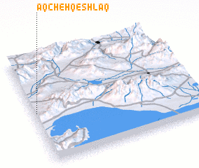 Places with similar names to Āqcheh Qeshlāq, Iran ::
// Āqcheh Qeshlāq (IR)
// Āqcheh Qeshlāq (IR)
Disclaimer :: Information on this page comes without warranty of any kind |
||
|
Where is Āqcheh Qeshlāq? Elevation and coordinates ::
Latitude (lat): 38°29'0"N Longitude (lon): 45°1'0"E
Elevation (approx.): 1133m (map arrows pan, magnifying glasses zoom) |
||
|
Visiting Āqcheh Qeshlāq? Hotel/Accommodation ::
Book a hotel in Āqcheh Qeshlāq Travel Guide ::
Buy a travel guide for Iran rental cars ::
car rental offers GPS waypoint ::
download a GPX waypoint (PoI) of Āqcheh Qeshlāq for your GPS receiver
|
||