|
search place name
|
||
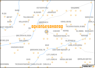
Āqkand-e S̄amaraq (Ostān-e Āz̄arbāyjān-e Sharqī, Iran)Āqkand-e S̄amaraq is a town in the Ostān-e Āz̄arbāyjān-e Sharqī region of Iran. An overview map of the region around Āqkand-e S̄amaraq is displayed below.
regional and 3d topo map of Āqkand-e S̄amaraq, Iran ::
Āqkand-e S̄amaraq airports ::
The nearest airport is TBZ - Tabriz Intl, located 87.0 km north of Āqkand-e S̄amaraq.
Nearby towns ::
‘Eshratābād (0.0km north) //
Chāy Bāghī (1.9km south) //
Varjovī (2.2km south west) //
Chekān (2.9km east) //
Marāgheh (3.7km north) //
Tāzeh Kand-e Soflá (3.5km south east) //
Gollar (4.0km north) //
Amīr (5.6km south) //
Pahrābād (4.6km west) //
Tāzeh Kand-e ‘Olyā (4.8km south east) //
Chavān-e ‘Alamdār (4.8km north east) //
Darband (5.8km south east) //
Qeshlāq-e Amīr (6.3km south east) //
Heraq (5.9km east) //
Ḩamzehābād (7.4km north) //
Jahāngīr (7.6km north) //
Qarā Borqa‘ (7.6km north) //
Kāmelābād (7.0km north east) //
Khāneqāh (7.0km south west) //
‘Alavīān (8.0km north) //
Qareh Nāz-e ‘Olyā (8.0km south) //
Āqbolāgh-e ‘Alamdār (8.1km south east) //
Ţālebkhān (8.1km north west) //
Gowy Daraq-e Soflá (8.6km south east) //
Novā (8.6km north west) //
Mūsá Daraq (8.6km south west) //
[all distances 'as the bird flies' and approximate] 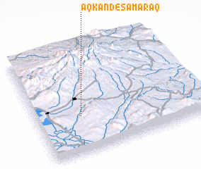 Places with similar names to Āqkand-e S̄amaraq, Iran :: Disclaimer :: Information on this page comes without warranty of any kind |
||
|
Where is Āqkand-e S̄amaraq? Elevation and coordinates ::
Latitude (lat): 37°21'0"N Longitude (lon): 46°16'0"E
Elevation (approx.): 1449m (map arrows pan, magnifying glasses zoom) |
||
|
Visiting Āqkand-e S̄amaraq? Hotel/Accommodation ::
Book a hotel in Āqkand-e S̄amaraq Travel Guide ::
Buy a travel guide for Iran rental cars ::
car rental offers GPS waypoint ::
download a GPX waypoint (PoI) of Āqkand-e S̄amaraq for your GPS receiver
|
||