|
search place name
|
||
Aqtalat (Iran)Aqtalat is a town in Iran. An overview map of the region around Aqtalat is displayed below.
regional and 3d topo map of Aqtalat, Iran ::
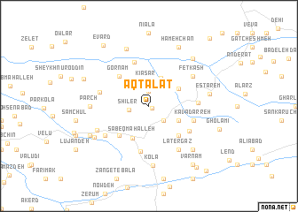
Nearby towns ::
Aftelet (0.4km south east) //
Kīāsar-e Pā'īn (1.9km north) //
Shīler (2.1km west) //
Sang Darreh (2.4km south east) //
Kīā Sar (3.1km north) //
Bīsheh Boneh (2.8km north west) //
Band-e Sar (3.7km north) //
Ghār Dīvkhāneh (3.5km south east) //
Kaftar Gār (3.7km north east) //
Sābeq Maḩalleh (4.4km south) //
Kord Maḩalleh (4.8km south west) //
Gornām (4.8km north west) //
Kovā (4.8km south east) //
Chāneh Pol (5.8km north) //
‘Īdīn (5.8km south) //
Kavā (5.1km south east) //
Kavā Darreh (4.9km east) //
Vaneshīd (5.0km east) //
Metkāzīn (5.2km west) //
Lamrad (5.8km south west) //
Fetkash (5.8km north east) //
Latergāz (6.3km south east) //
Bermā-ye ‘Ashrostāq (6.1km south west) //
Pārch (6.0km west) //
Kolā (7.6km south) //
Ramadān (7.5km north) //
Estārem (6.4km east) //
Chālū (7.1km south east) //
Jūrband va Jīrband (6.8km south west) //
[all distances 'as the bird flies' and approximate] 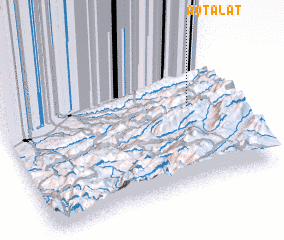 Places with similar names to Aqtalat, Iran ::
Disclaimer :: Information on this page comes without warranty of any kind |
||
|
Where is Aqtalat? Elevation and coordinates ::
Latitude (lat): 36°33'0"N Longitude (lon): 53°50'0"E
Elevation (approx.): 1640m (map arrows pan, magnifying glasses zoom) |
||
|
Visiting Aqtalat? Hotel/Accommodation ::
Book a hotel in Aqtalat Travel Guide ::
Buy a travel guide for Iran rental cars ::
car rental offers GPS waypoint ::
download a GPX waypoint (PoI) of Aqtalat for your GPS receiver
|
||