|
search place name
|
||
‘Arab Kalū (Iran)‘Arab Kalū is a town in Iran. An overview map of the region around ‘Arab Kalū is displayed below.
regional and 3d topo map of ‘Arab Kalū, Iran ::
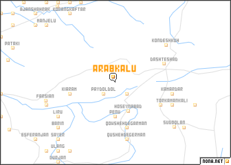
Nearby towns ::
Khosrowābād (2.4km south east) //
Pāy Doldol (2.4km south west) //
Ḩoseynābād (5.0km south) //
Penū (5.6km south) //
Qowsheh Degarmān (7.6km south) //
Kīārām (6.2km west) //
Korang (7.0km south east) //
Dasht-e Shād (7.0km north east) //
Kondeshkūh (8.9km north east) //
[all distances 'as the bird flies' and approximate] 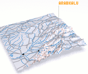 Places with similar names to ‘Arab Kalū, Iran ::
// Arbuckle (US)
// Arbuckle (US)
// Arab-Kala (TM)
// Arābi Kili (PK)
// Arbi Kili (PK)
// Arbakol' (RU)
// Arbuckle (US)
// Ara Bacalle (ET)
Disclaimer :: Information on this page comes without warranty of any kind |
||
|
Where is ‘Arab Kalū? Elevation and coordinates ::
Latitude (lat): 37°15'0"N Longitude (lon): 55°42'0"E
Elevation (approx.): 1543m (map arrows pan, magnifying glasses zoom) |
||
|
Visiting ‘Arab Kalū? Hotel/Accommodation ::
Book a hotel in ‘Arab Kalū Travel Guide ::
Buy a travel guide for Iran rental cars ::
car rental offers GPS waypoint ::
download a GPX waypoint (PoI) of ‘Arab Kalū for your GPS receiver
|
||