|
search place name
|
||
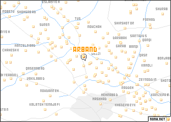
Arband (Khorāsān, Iran)Arband is a town in the Khorāsān region of Iran. An overview map of the region around Arband is displayed below.
regional and 3d topo map of Arband, Iran ::
Arband airports ::
The nearest airport is ASB - Ashkhabad Ashgabat, located 208.7 km north west of Arband.
Nearby towns ::
Ebrāhīmābād (0.9km south east) //
Kashaf (1.1km south) //
Ferīzī (1.0km east) //
Sākhtemān (1.7km north) //
Nūrī (1.9km north west) //
Gezzī (2.0km east) //
Ḩasan Shahāb (2.7km north) //
Khīn-e ‘Arab (2.4km south east) //
Mehdīābād (2.8km south west) //
Kūshk-e Mehdī (2.7km west) //
Rūd-e Khīn (2.8km east) //
Fatḩābād (3.5km south) //
Now Deh (2.9km west) //
Kārīzak (3.5km south east) //
Esmā‘īlābād (3.7km south east) //
Kalāteh-ye Qāẕī (3.8km north) //
Now Deh (3.3km west) //
Bahār (3.7km north east) //
Parkandābād (3.7km north west) //
Būghā (3.9km south east) //
Kalāteh-ye Būgheh (5.0km south east) //
Ābkū-ye Bālā (5.1km south west) //
Bāghū (4.5km east) //
Mālābād (5.1km south east) //
Nokhowdak (5.5km south) //
Golshād (4.9km south east) //
Bāgh-e Farhād Gerd (4.9km north east) //
Tokhm Marz (5.0km north west) //
Kholqābād (4.8km north east) //
[all distances 'as the bird flies' and approximate]  Places with similar names to Arband, Iran ::
// Arrebenta (PT)
// Aribinda (BF)
// Arab-Band (UZ)
// Arabband (UZ)
// Arab Bānda (PK)
// Arbent (FR)
// Arba Aounate (MA)
// Arroio Bonito (BR)
Disclaimer :: Information on this page comes without warranty of any kind |
||
|
Where is Arband? Elevation and coordinates ::
Latitude (lat): 36°22'49"N Longitude (lon): 59°34'55"E
Elevation (approx.): 979m (map arrows pan, magnifying glasses zoom) |
||
|
Visiting Arband? Hotel/Accommodation ::
Book a hotel in Arband Travel Guide ::
Buy a travel guide for Iran rental cars ::
car rental offers GPS waypoint ::
download a GPX waypoint (PoI) of Arband for your GPS receiver
|
||