|
search place name
|
||
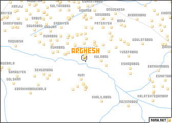
Arghesh (Khorāsān, Iran)Arghesh is a town in the Khorāsān region of Iran. An overview map of the region around Arghesh is displayed below.
regional and 3d topo map of Arghesh, Iran ::
Arghesh airports ::
The nearest airport is ASB - Ashkhabad Ashgabat, located 220.6 km north of Arghesh.
Nearby towns ::
Qāderābād (1.2km north) //
Bāgh-e Ja‘farābād (1.2km north) //
Ḩeşār-e Jalāl (1.2km north) //
Qāderābād (1.9km north) //
Kūlābād (2.7km east) //
Ja‘farābād (3.9km north) //
Mūrī (3.9km south) //
Kārīz-e Şabāḩ (3.8km north east) //
‘Eshqābād-e Kohneh (3.9km north west) //
Eqbālī (4.0km north) //
Amīrābād (4.0km north) //
Naz̧argāh-e Shūrī (3.7km north west) //
Nūrābād (4.1km north west) //
Zanqāh (3.6km east) //
Qāsemābād (4.6km north) //
Bozrū (4.0km north west) //
Shūrī (4.1km north west) //
Kāz̧emābād (4.9km south) //
Raḩīmābād (4.9km north) //
Nowrūzābād (5.0km south) //
Barf Rīz (5.0km south) //
Fatḩābād (4.7km north east) //
Moz̧affarābād (5.4km south) //
Ebrāhīmābād-e Hāshemī (4.6km north east) //
Moz̧affarābād (5.6km south) //
Badī‘ābād (5.1km north west) //
Ḩasanābād (5.7km south) //
Shād Mehneh (6.0km north) //
Manşūrīyeh (6.1km north) //
[all distances 'as the bird flies' and approximate]  Places with similar names to Arghesh, Iran ::
Disclaimer :: Information on this page comes without warranty of any kind |
||
|
Where is Arghesh? Elevation and coordinates ::
Latitude (lat): 36°3'0"N Longitude (lon): 58°54'59"E
Elevation (approx.): 1153m (map arrows pan, magnifying glasses zoom) |
||
|
Visiting Arghesh? Hotel/Accommodation ::
Book a hotel in Arghesh Travel Guide ::
Buy a travel guide for Iran rental cars ::
car rental offers GPS waypoint ::
download a GPX waypoint (PoI) of Arghesh for your GPS receiver
|
||