|
search place name
|
||
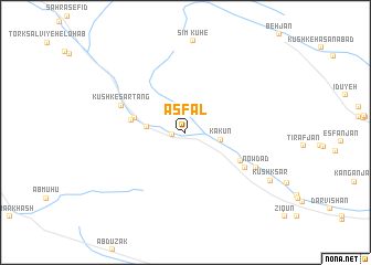
Asfal (Fārs, Iran)Asfal is a town in the Fārs region of Iran. An overview map of the region around Asfal is displayed below.
regional and 3d topo map of Asfal, Iran ::
Asfal airports ::
The nearest airport is SYZ - Shiraz Shahid Dastghaib Intl, located 95.3 km north of Asfal.
Nearby towns ::
Mazeh Kān (1.2km west) //
Kākūn (3.2km east) //
Ārjūyeh (3.4km west) //
Karrādeh (4.8km west) //
Kūshk (5.0km west) //
Dūzeh (5.7km south east) //
Kūshk-e Sar Tang (6.3km north west) //
Hamandeh (6.4km south east) //
Now Dād (7.2km south east) //
Kūshk Sār (9.0km south east) //
[all distances 'as the bird flies' and approximate] 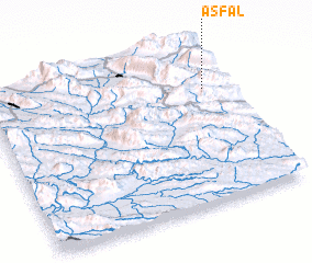 Places with similar names to Asfal, Iran ::
// Āsāveleh (IR)
// Āsāvleh (IR)
// Asfalah (SA)
// Asfalou (MA)
// Aussevielle (FR)
// Azeville (FR)
// As Sufaylah (LB)
// Asfalou (MA)
// Asfal (YE)
// As Siflah (YE)
Disclaimer :: Information on this page comes without warranty of any kind |
||
|
Where is Asfal? Elevation and coordinates ::
Latitude (lat): 28°43'36"N Longitude (lon): 52°54'34"E
Elevation (approx.): 1239m (map arrows pan, magnifying glasses zoom) |
||
|
Visiting Asfal? Hotel/Accommodation ::
Book a hotel in Asfal Travel Guide ::
Buy a travel guide for Iran rental cars ::
car rental offers GPS waypoint ::
download a GPX waypoint (PoI) of Asfal for your GPS receiver
|
||