|
search place name
|
||
Azdārān (Iran)Azdārān is a town in Iran. An overview map of the region around Azdārān is displayed below.
regional and 3d topo map of Azdārān, Iran ::
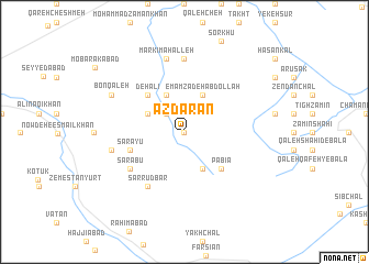
Nearby towns ::
Sāsang (0.0km north) //
Sarān (2.4km north west) //
Largāh (3.5km north west) //
Qorbānābād (4.0km north) //
Emāmzādeh ‘Abdollāh (4.0km north) //
Māzū Takhteh (4.0km south) //
Deh ‘Alī (4.7km north west) //
Pābīā (4.7km south east) //
Sārāyū (4.8km south west) //
Sar Rūdbār (6.3km south west) //
Sarābū (5.8km south west) //
Lūlom (7.4km north) //
Markī Maḩalleh (7.6km north) //
Sarā Moḩammad Ḩoseyn (6.2km west) //
Bon Qal‘eh (7.0km north west) //
[all distances 'as the bird flies' and approximate] 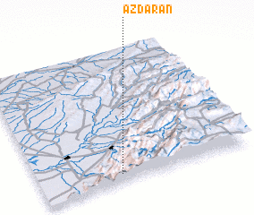 Places with similar names to Azdārān, Iran ::
Disclaimer :: Information on this page comes without warranty of any kind |
||
|
Where is Azdārān? Elevation and coordinates ::
Latitude (lat): 37°4'0"N Longitude (lon): 55°23'0"E
Elevation (approx.): 679m (map arrows pan, magnifying glasses zoom) |
||
|
Visiting Azdārān? Hotel/Accommodation ::
Book a hotel in Azdārān Travel Guide ::
Buy a travel guide for Iran rental cars ::
car rental offers GPS waypoint ::
download a GPX waypoint (PoI) of Azdārān for your GPS receiver
|
||