|
search place name
|
||
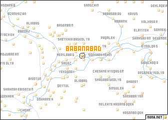
Bābānābād (Ostān-e Kermānshāh, Iran)Bābānābād is a town in the Ostān-e Kermānshāh region of Iran. An overview map of the region around Bābānābād is displayed below.
regional and 3d topo map of Bābānābād, Iran ::
Bābānābād airports ::
The nearest airport is KSH - Bakhtaran Shahid Ashrafi Esfahani, located 35.8 km west of Bābānābād.
Other airports nearby include SDG - Sanandaj (102.1 km north west), Nearby towns ::
Yek Joftī (0.0km north) //
Samangān-e Soflá (1.8km north) //
Gorgavand (1.5km west) //
Īlkhānīābād (1.5km east) //
Choqā Jān‘alī (2.4km south west) //
Sharīfābād (2.4km north west) //
Samangān-e ‘Olyā (2.7km north east) //
Sardārābād (3.7km north) //
Sorkheh Mehrī (3.1km east) //
Gāvkol-e Soflá (3.2km east) //
Herīlābād (3.3km west) //
Sheykhīābād-e ‘Olyā (3.9km north west) //
Sagāz (3.6km south west) //
Māl Amīrī-ye Soflá (4.0km south) //
Maḩmūdābād-e Zardāb (4.0km north) //
Choqā Golān (4.0km north) //
Sheykhīābād-e Soflá (4.5km north west) //
Yekdangī (4.8km south west) //
Asadābād (4.8km south east) //
Maḩmūdābād (4.6km east) //
Kākāvand (5.6km south) //
Zardāb-e Moḩeb (4.7km west) //
‘Alīābād (5.8km south) //
Gāvkol-e ‘Olyā (4.9km east) //
Āhangarān (4.9km east) //
Maḩmūdābād-e Kāshāntū (5.1km north west) //
Takht-e Shīrīn (5.4km south west) //
Nāderābād (5.6km south west) //
Cheshmeh-ye Qāder (5.9km south east) //
[all distances 'as the bird flies' and approximate] 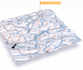 Places with similar names to Bābānābād, Iran :: Disclaimer :: Information on this page comes without warranty of any kind |
||
|
Where is Bābānābād? Elevation and coordinates ::
Latitude (lat): 34°26'0"N Longitude (lon): 47°32'0"E
Elevation (approx.): 1286m (map arrows pan, magnifying glasses zoom) |
||
|
Visiting Bābānābād? Hotel/Accommodation ::
Book a hotel in Bābānābād Travel Guide ::
Buy a travel guide for Iran rental cars ::
car rental offers GPS waypoint ::
download a GPX waypoint (PoI) of Bābānābād for your GPS receiver
|
||