|
search place name
|
||
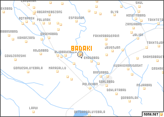
Bādaki (Fārs, Iran)Bādaki is a town in the Fārs region of Iran. An overview map of the region around Bādaki is displayed below.
regional and 3d topo map of Bādaki, Iran ::
Bādaki airports ::
The nearest airport is SYZ - Shiraz Shahid Dastghaib Intl, located 44.0 km south of Bādaki.
Other airports nearby include BUZ - Bushehr (214.5 km south west), AZD - Yazd Shahid Sadooghi (264.9 km north east), Nearby towns ::
‘Alīābād-e Pā'īn (2.0km south west) //
‘Emādābād (2.1km east) //
‘Alīābād-e Bālā (3.2km west) //
Ḩasanābād (3.5km east) //
Kūh Sabz (4.1km west) //
Gondeshlū-ye Pā'īn (5.1km south west) //
Ozūn Darreh (5.3km south west) //
Bādekī (4.8km west) //
Deh Bīd (5.0km east) //
‘Amrūābād (5.6km south east) //
Marāgallū (5.7km south west) //
Fatḩābād (5.8km north east) //
Pol-e Khān (7.0km south) //
Fakhrābād-e Pāʼīn (6.5km north east) //
Jevenjān (6.3km east) //
Marv Dasht (6.6km south east) //
Sahlābād (8.0km south east) //
Fakhrābād (8.1km north west) //
Esfadrān (8.5km north) //
Qāsemābād (8.0km north west) //
Fakhrābād-e ‘Olya (8.8km north west) //
Mehrābād (9.3km north west) //
Mojtame‘-e Gūsht-e Fārs (10.3km north west) //
Dowlatābād (10.7km south east) //
Fālūnak (11.0km north west) //
[all distances 'as the bird flies' and approximate]  Places with similar names to Bādaki, Iran ::
Disclaimer :: Information on this page comes without warranty of any kind |
||
|
Where is Bādaki? Elevation and coordinates ::
Latitude (lat): 29°54'40"N Longitude (lon): 52°44'58"E
Elevation (approx.): 1598m (map arrows pan, magnifying glasses zoom) |
||
|
Visiting Bādaki? Hotel/Accommodation ::
Book a hotel in Bādaki Travel Guide ::
Buy a travel guide for Iran rental cars ::
car rental offers GPS waypoint ::
download a GPX waypoint (PoI) of Bādaki for your GPS receiver
|
||