|
search place name
|
||
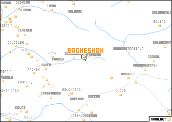
Bāgh-e Shāh (Eşfahān, Iran)Bāgh-e Shāh is a town in the Eşfahān region of Iran. An overview map of the region around Bāgh-e Shāh is displayed below.
regional and 3d topo map of Bāgh-e Shāh, Iran ::
Bāgh-e Shāh airports ::
The nearest airport is QMJ - Masjed Soleiman Shahid Asyaee, located 131.7 km south west of Bāgh-e Shāh.
Other airports nearby include AWZ - Ahwaz (219.1 km south west), Nearby towns ::
Farsesh (1.6km east) //
Qarahkhān (2.2km west) //
Fahreh (5.0km west) //
Cheshmeh-ye Ra'īsān (6.0km south east) //
Homā (6.1km west) //
Eslāmābād (7.6km south) //
Abowl (8.0km south west) //
Mazra‘eh-ye Mīr (7.9km south west) //
Sokkān (8.8km south) //
Haveh (7.5km west) //
Rameh Char (8.3km south west) //
Kesed (8.2km south west) //
Korūzūm (8.4km south west) //
Gūrāb (9.8km south east) //
Zard Fahreh (10.2km south west) //
[all distances 'as the bird flies' and approximate] 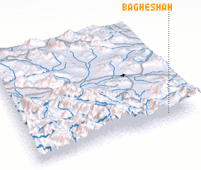 Places with similar names to Bāgh-e Shāh, Iran ::
Disclaimer :: Information on this page comes without warranty of any kind |
||
|
Where is Bāgh-e Shāh? Elevation and coordinates ::
Latitude (lat): 33°5'0"N Longitude (lon): 49°51'0"E
Elevation (approx.): 2492m (map arrows pan, magnifying glasses zoom) |
||
|
Visiting Bāgh-e Shāh? Hotel/Accommodation ::
Book a hotel in Bāgh-e Shāh Travel Guide ::
Buy a travel guide for Iran rental cars ::
car rental offers GPS waypoint ::
download a GPX waypoint (PoI) of Bāgh-e Shāh for your GPS receiver
|
||