|
search place name
|
||
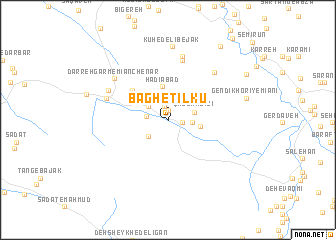
Bāgh-e Tīlkū (Ostān-e Kohgīlūyeh va Būyer Aḩmad, Iran)Bāgh-e Tīlkū is a town in the Ostān-e Kohgīlūyeh va Būyer Aḩmad region of Iran. An overview map of the region around Bāgh-e Tīlkū is displayed below.
regional and 3d topo map of Bāgh-e Tīlkū, Iran ::
Bāgh-e Tīlkū airports ::
The nearest airport is SYZ - Shiraz Shahid Dastghaib Intl, located 197.6 km south east of Bāgh-e Tīlkū.
Other airports nearby include BUZ - Bushehr (214.5 km south), QMJ - Masjed Soleiman Shahid Asyaee (223.6 km north west), Nearby towns ::
Dam Chenār-e Vasaţ (1.1km north) //
Dam Seh Vel (1.5km north) //
Dam Chenār-e Pāʼīn (1.4km east) //
Cheshmeh Dozdak (2.1km west) //
Dam Chenār-e Sālār ‘Azīzī (2.4km north west) //
Pas Gach-e Hādīābād (2.5km south west) //
‘Alī Karamī (2.4km east) //
Qal‘eh ‘Azīzī (2.5km east) //
Hādīābād (3.7km north) //
Deh Now-e ‘Alī Karamī (3.2km east) //
Dam Chenār-e Maskūr (4.8km north west) //
Mūger (6.8km north) //
Qal‘eh-ye Kohneh (6.3km north west) //
Mūjerd (7.2km north) //
Chenār Barm-e Bālā (6.9km north east) //
Mīān Chenār (6.6km north west) //
Darreh Garm-e Mīān Chenār (6.8km north west) //
Kūh-e Delī Bejak (8.1km north) //
Gendī Khorī-ye Mīānī (7.8km east) //
Deh Sheykh (9.6km north east) //
Sartang-e Pā'īn (9.0km north east) //
[all distances 'as the bird flies' and approximate] 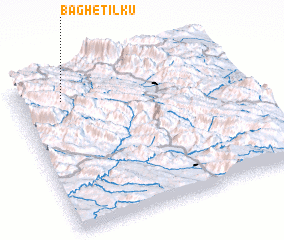 Places with similar names to Bāgh-e Tīlkū, Iran :: Disclaimer :: Information on this page comes without warranty of any kind |
||
|
Where is Bāgh-e Tīlkū? Elevation and coordinates ::
Latitude (lat): 30°51'12"N Longitude (lon): 51°12'10"E
Elevation (approx.): 2012m (map arrows pan, magnifying glasses zoom) |
||
|
Visiting Bāgh-e Tīlkū? Hotel/Accommodation ::
Book a hotel in Bāgh-e Tīlkū Travel Guide ::
Buy a travel guide for Iran rental cars ::
car rental offers GPS waypoint ::
download a GPX waypoint (PoI) of Bāgh-e Tīlkū for your GPS receiver
|
||