|
search place name
|
||
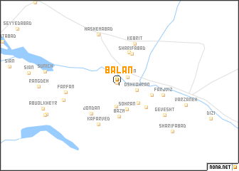
Balān (Eşfahān, Iran)Balān is a town in the Eşfahān region of Iran. An overview map of the region around Balān is displayed below.
regional and 3d topo map of Balān, Iran ::
Balān airports ::
The nearest airport is AZD - Yazd Shahid Sadooghi, located 173.1 km east of Balān.
Nearby towns ::
Abūol Ma‘ālī (0.5km north west) //
Qūrtān (1.7km north east) //
Āsengerān (2.4km east) //
Oshkohrān (2.4km east) //
Mehrān (3.4km south) //
Sohrān (3.9km south) //
Sonbolābād (3.7km south east) //
Bazm (4.8km south) //
Shekān (4.5km east) //
Sharīfābād (5.2km north) //
Yasnā (4.9km south east) //
Bāqerābād (5.4km north) //
Jondān (5.7km south west) //
Kafarved (6.7km south west) //
Kebrīt (6.9km north) //
Farj Vīz (6.0km east) //
Gevesht (7.5km south east) //
Fārfān (7.2km west) //
Hāshemābād (8.5km north) //
Kafrān (7.8km west) //
Sharīfābād (10.0km south east) //
[all distances 'as the bird flies' and approximate] 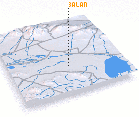 Places with similar names to Balān, Iran ::
Disclaimer :: Information on this page comes without warranty of any kind |
||
|
Where is Balān? Elevation and coordinates ::
Latitude (lat): 32°26'48"N Longitude (lon): 52°33'17"E
Elevation (approx.): 1482m (map arrows pan, magnifying glasses zoom) |
||
|
Visiting Balān? Hotel/Accommodation ::
Book a hotel in Balān Travel Guide ::
Buy a travel guide for Iran rental cars ::
car rental offers GPS waypoint ::
download a GPX waypoint (PoI) of Balān for your GPS receiver
|
||