|
search place name
|
||
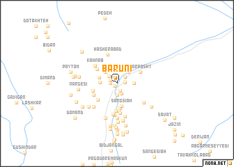
Bārūnī (Kermān, Iran)Bārūnī is a town in the Kermān region of Iran. An overview map of the region around Bārūnī is displayed below.
regional and 3d topo map of Bārūnī, Iran ::
Bārūnī airports ::
The nearest airport is KER - Kerman, located 160.3 km north west of Bārūnī.
Other airports nearby include BND - Bandar Abbass Intl (257.5 km south west), Nearby towns ::
Gol Malek (0.5km south west) //
Deh Radīn (1.0km west) //
Shīrkosh (1.1km north west) //
Kangarī (1.3km south) //
Maḩmūdābād (1.2km east) //
Dahaneh (1.6km north east) //
Gel Bīdū'yeh (1.8km south) //
Marghak (1.7km north west) //
Kan Gorgī (1.9km south) //
‘Eshqābād (1.9km south) //
Deh Now (2.5km north east) //
Kahnow (2.5km north west) //
Āb Shūrū (2.5km north west) //
Gabārū (2.4km east) //
Tāfīāt (2.4km west) //
Seh Darūn (2.6km west) //
Sang Sīāh (3.7km south) //
Bīdkhūn-e Morghak (3.6km north west) //
Bāgh Dasht (3.9km south) //
Darreh Derāz (3.7km south west) //
Dow Jangān (3.6km west) //
Do Gol (3.7km north east) //
Sar Posht (3.7km north east) //
Senjed Khoshk (3.7km south west) //
Ḩasan Khandān (3.7km south west) //
Qanbarī (4.4km south) //
‘Abd oş Şamadīyeh (4.5km south) //
Kahn Āb (4.2km north west) //
Dasht-e ‘Alī (4.8km south) //
[all distances 'as the bird flies' and approximate] 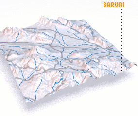 Places with similar names to Bārūnī, Iran ::
Disclaimer :: Information on this page comes without warranty of any kind |
||
|
Where is Bārūnī? Elevation and coordinates ::
Latitude (lat): 29°6'0"N Longitude (lon): 57°55'0"E
Elevation (approx.): 1975m (map arrows pan, magnifying glasses zoom) |
||
|
Visiting Bārūnī? Hotel/Accommodation ::
Book a hotel in Bārūnī Travel Guide ::
Buy a travel guide for Iran rental cars ::
car rental offers GPS waypoint ::
download a GPX waypoint (PoI) of Bārūnī for your GPS receiver
|
||