|
search place name
|
||
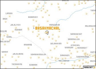
Bāsak Māchāl (Ardabīl, Iran)Bāsak Māchāl is a town in the Ardabīl region of Iran. An overview map of the region around Bāsak Māchāl is displayed below.
regional and 3d topo map of Bāsak Māchāl, Iran ::
Bāsak Māchāl airports ::
The nearest airport is RAS - Rasht, located 57.3 km east of Bāsak Māchāl.
Other airports nearby include RZR - Ramsar (157.0 km east), Nearby towns ::
Vargūn Gūrā (1.0km south) //
Palang Bīsheh (1.1km north west) //
Khūreh Zhīyeh (1.5km east) //
Tītī Pārgā (2.1km south east) //
Āstāneh (2.3km south west) //
Dīz Āb (2.8km south west) //
Kūrkā (2.9km west) //
Pardeh Sar (3.5km north east) //
Dandūneh (3.5km south east) //
Īlāt Zamīn (3.3km north west) //
Rash Darreh Posht (3.4km west) //
Rafī‘ Kūreh (3.4km east) //
Bābā Kohneh (3.8km east) //
Dashneh Mīāneh (5.2km north) //
Sū' Poshteh (4.7km north west) //
Delah Khānī (5.3km south east) //
Vaneh Khānī (5.7km south) //
Tandar Bolandgāh (4.9km west) //
Tūtūnsham (6.2km south) //
Sūteh Kesh (5.6km north west) //
Tanīān (6.4km north west) //
Khandīleh Posht (7.0km north) //
Tofangsāz (7.5km north) //
Kolīcheh Sar (6.4km west) //
Akbarkān (7.3km north west) //
Sefīd Dasht (6.7km west) //
Mīskā (6.9km south east) //
Vāshyār (8.7km north) //
Emāmzādeh Ebrāhīm (8.9km south) //
[all distances 'as the bird flies' and approximate] 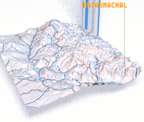 Places with similar names to Bāsak Māchāl, Iran :: Disclaimer :: Information on this page comes without warranty of any kind |
||
|
Where is Bāsak Māchāl? Elevation and coordinates ::
Latitude (lat): 37°14'59"N Longitude (lon): 48°57'58"E
Elevation (approx.): 1308m (map arrows pan, magnifying glasses zoom) |
||
|
Visiting Bāsak Māchāl? Hotel/Accommodation ::
Book a hotel in Bāsak Māchāl Travel Guide ::
Buy a travel guide for Iran rental cars ::
car rental offers GPS waypoint ::
download a GPX waypoint (PoI) of Bāsak Māchāl for your GPS receiver
|
||