|
search place name
|
||
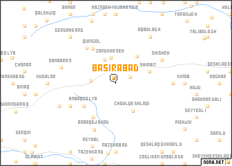
Başīrābād (Ostān-e Āz̄arbāyjān-e Sharqī, Iran)Başīrābād is a town in the Ostān-e Āz̄arbāyjān-e Sharqī region of Iran. An overview map of the region around Başīrābād is displayed below.
regional and 3d topo map of Başīrābād, Iran ::
Başīrābād airports ::
The nearest airport is TBZ - Tabriz Intl, located 102.6 km south west of Başīrābād.
Nearby towns ::
Galīzeh (2.0km north east) //
Bābājān (3.2km west) //
Zardkhāneh (4.1km north) //
Līmlū (4.0km north) //
Chowl Qeshlāqī (5.0km south east) //
Sīah Dowlān (5.0km north east) //
Shīrbīt (4.6km north east) //
Anbāq-e ‘Olyā (5.5km south west) //
Anbāq-e Ḩājjīkhān (6.3km south west) //
Anbāq-e Sorkhā-ye Vostá (6.3km south west) //
Qūrīgol (6.3km north west) //
Kīrdāsī (6.7km north west) //
Āqdīvār (6.9km south west) //
Shīsheh (6.9km north east) //
Anbāq-e Javād (8.1km south) //
Sāmbarān (7.3km west) //
Āqbolāgh (8.6km north east) //
Gerdahsang (9.4km north west) //
[all distances 'as the bird flies' and approximate]  Places with similar names to Başīrābād, Iran ::
Disclaimer :: Information on this page comes without warranty of any kind |
||
|
Where is Başīrābād? Elevation and coordinates ::
Latitude (lat): 38°33'0"N Longitude (lon): 47°17'0"E
Elevation (approx.): 1688m (map arrows pan, magnifying glasses zoom) |
||
|
Visiting Başīrābād? Hotel/Accommodation ::
Book a hotel in Başīrābād Travel Guide ::
Buy a travel guide for Iran rental cars ::
car rental offers GPS waypoint ::
download a GPX waypoint (PoI) of Başīrābād for your GPS receiver
|
||