|
search place name
|
||
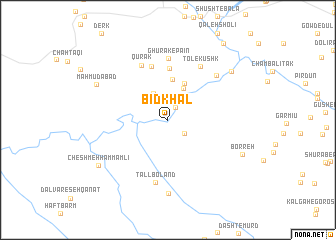
Bīd Khal (Fārs, Iran)Bīd Khal is a town in the Fārs region of Iran. An overview map of the region around Bīd Khal is displayed below.
regional and 3d topo map of Bīd Khal, Iran ::
Bīd Khal airports ::
The nearest airport is BUZ - Bushehr, located 144.6 km south of Bīd Khal.
Other airports nearby include SYZ - Shiraz Shahid Dastghaib Intl (155.0 km south east), QMJ - Masjed Soleiman Shahid Asyaee (269.6 km north west), Nearby towns ::
Kūh-e Mūrd (1.5km north east) //
Nadīdeh (2.1km south east) //
Kūh Mūrd-e Posht-e Kūh (3.2km north west) //
Cham Khūn (3.9km north east) //
Ḥājjī Qalandar (4.4km north) //
Darreh Darreh (4.6km north) //
Ghūrak-e Bālā (5.7km north) //
Ghūrak-e Mīānī (6.2km north) //
Qūrak (6.6km north west) //
Ghūrak-e Pā'īn (6.9km north) //
Tol-e Kūshk (6.8km north east) //
Tall Boland (7.1km south) //
Bīdastān (6.8km north east) //
Dalvār-e Kūh Sīāh (8.2km south) //
Maḩmūdābād (7.9km north west) //
Cham Espīd (8.2km north east) //
Borreh (8.2km south east) //
Cheshmeh Ḩammām Lī (8.4km south west) //
Bīdastān (10.0km north east) //
[all distances 'as the bird flies' and approximate] 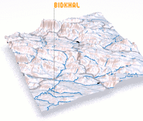 Places with similar names to Bīd Khal, Iran ::
// Bīdkholah (IR)
// Bātikhāli (BD)
// Batkholu (IN)
// Bada Khel (PK)
// Badi Khel (PK)
// Bat Khela (PK)
// Badī‘ Kheyl (IR)
// Bodah Kheyl (AF)
// Bāt Khēl (AF)
Disclaimer :: Information on this page comes without warranty of any kind |
||
|
Where is Bīd Khal? Elevation and coordinates ::
Latitude (lat): 30°12'47"N Longitude (lon): 51°11'1"E
Elevation (approx.): 827m (map arrows pan, magnifying glasses zoom) |
||
|
Visiting Bīd Khal? Hotel/Accommodation ::
Book a hotel in Bīd Khal Travel Guide ::
Buy a travel guide for Iran rental cars ::
car rental offers GPS waypoint ::
download a GPX waypoint (PoI) of Bīd Khal for your GPS receiver
|
||