|
search place name
|
||
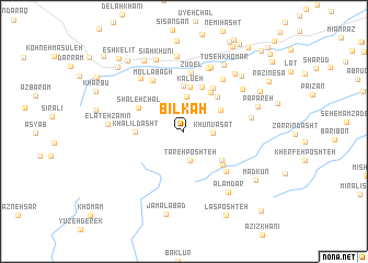
Bīlkāh (Gīlān, Iran)Bīlkāh is a town in the Gīlān region of Iran. An overview map of the region around Bīlkāh is displayed below.
regional and 3d topo map of Bīlkāh, Iran ::
Bīlkāh airports ::
The nearest airport is RAS - Rasht, located 55.0 km north east of Bīlkāh.
Other airports nearby include RZR - Ramsar (146.3 km east), Nearby towns ::
Khūn Vasaţ (2.4km east) //
Tareh Poshteh (2.9km south) //
Sīāh Kesh (3.5km north) //
Qadamgāh (3.7km north east) //
Kalū‘eh (4.6km north) //
Āghūz Keleh (4.7km north) //
Parneh (4.2km south east) //
Delah Khānī (4.6km north east) //
Āhan Pol (4.8km north) //
Malāl (4.4km north east) //
Khalīl Dasht (3.9km west) //
Shāleh Chāl (4.4km north west) //
Kūreh (4.7km south east) //
Vaqfī (5.0km north east) //
Rīāneh (5.3km south east) //
Zūdel (6.0km north) //
Mollā Bāgh (5.8km north west) //
Sīkh Bon (6.2km north east) //
Dārām Dārām Bārān (6.8km north) //
Lanandīz (6.4km north west) //
Sīfestūn (5.6km east) //
Sīāh Bokūn (6.8km north) //
Jamād (6.4km north east) //
‘Alamdār (7.2km south east) //
Khomāreh Nesā (7.7km north) //
Elāteh Zamīn (6.2km west) //
Chopūl Kesh (7.2km north east) //
Tūseh Khomār (7.5km north east) //
Sīāh Khūnī (7.7km north) //
[all distances 'as the bird flies' and approximate] 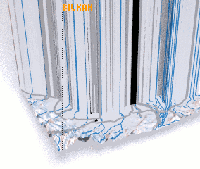 Places with similar names to Bīlkāh, Iran ::
Disclaimer :: Information on this page comes without warranty of any kind |
||
|
Where is Bīlkāh? Elevation and coordinates ::
Latitude (lat): 37°6'4"N Longitude (lon): 49°3'10"E
Elevation (approx.): 1244m (map arrows pan, magnifying glasses zoom) |
||
|
Visiting Bīlkāh? Hotel/Accommodation ::
Book a hotel in Bīlkāh Travel Guide ::
Buy a travel guide for Iran rental cars ::
car rental offers GPS waypoint ::
download a GPX waypoint (PoI) of Bīlkāh for your GPS receiver
|
||