|
search place name
|
||
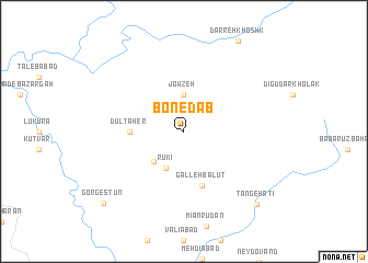
Bon-e Dāb (Khūzestān, Iran)Bon-e Dāb is a town in the Khūzestān region of Iran. An overview map of the region around Bon-e Dāb is displayed below.
regional and 3d topo map of Bon-e Dāb, Iran ::
Bon-e Dāb airports ::
The nearest airport is QMJ - Masjed Soleiman Shahid Asyaee, located 64.6 km south of Bon-e Dāb.
Other airports nearby include AWZ - Ahwaz (140.0 km south), KSH - Bakhtaran Shahid Ashrafi Esfahani (267.4 km north west), Nearby towns ::
Jowzeh (3.7km north) //
Rūkī (4.0km south west) //
Kūl Pāpā (4.0km south west) //
Dūl Ţāher (4.7km west) //
Galleh Balūţ (5.8km south) //
Tang-e Ḩatī (9.7km south east) //
Gorgestūn (10.1km south west) //
[all distances 'as the bird flies' and approximate]  Places with similar names to Bon-e Dāb, Iran ::
// Beni Atab (MA)
// Ban Ao Tu (1) (TH)
// Ban Du (1) (TH)
// Ban Not (1) (TH)
// Ban Taba (TH)
// Ban Tabo (TH)
// Ban To I Bo (TH)
// Bandabe (MG)
// Bandabe (MG)
// Bandabe (MG)
Disclaimer :: Information on this page comes without warranty of any kind |
||
|
Where is Bon-e Dāb? Elevation and coordinates ::
Latitude (lat): 32°34'0"N Longitude (lon): 49°6'0"E
Elevation (approx.): 905m (map arrows pan, magnifying glasses zoom) |
||
|
Visiting Bon-e Dāb? Hotel/Accommodation ::
Book a hotel in Bon-e Dāb Travel Guide ::
Buy a travel guide for Iran rental cars ::
car rental offers GPS waypoint ::
download a GPX waypoint (PoI) of Bon-e Dāb for your GPS receiver
|
||