|
search place name
|
||
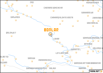
Bon Lār (Lorestān, Iran)Bon Lār is a town in the Lorestān region of Iran. An overview map of the region around Bon Lār is displayed below.
regional and 3d topo map of Bon Lār, Iran ::
Bon Lār airports ::
The nearest airport is KSH - Bakhtaran Shahid Ashrafi Esfahani, located 124.0 km north west of Bon Lār.
Other airports nearby include QMJ - Masjed Soleiman Shahid Asyaee (205.5 km south east), SDG - Sanandaj (221.7 km north), Nearby towns ::
Lavār (2.6km south east) //
Sarenjeh-ye Zīvdār (3.3km south east) //
Ţāq-e ‘Abbās‘alī (4.9km south east) //
Gūr Gūrī (4.9km south east) //
Chahār Qal'eh-ye Sādāt (5.3km north east) //
Chahār Qal‘eh-ye ‘Olyā (6.7km north east) //
Chahār Qal‘eh-ye Vosţá (6.7km north east) //
Chahār Qal‘eh-ye Soflá (6.7km north east) //
Barāftāb (7.3km south east) //
Kalāt (7.3km south east) //
Leylān Cham (8.0km south east) //
Chahār Qal‘eh-ye Bārānī (7.5km north east) //
Kalek-e Zūrāntel (8.2km south east) //
Jolgeh-ye Khalaj-e Soflá (9.3km south east) //
Tang-e Dārāb-e Rīkā (9.6km north west) //
Jolgeh-ye Khalaj-e ‘Olyā (10.7km south east) //
[all distances 'as the bird flies' and approximate] 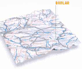 Places with similar names to Bon Lār, Iran ::
// Ban Lao Ri (TH)
// Benalauría (ES)
// Benllera (ES)
// Beneh Lar (IR)
// Bunlurea (ID)
// Ban Lori (NG)
// Bounlaré (TG)
// Bonlier (FR)
// Binǝlǝr (AZ)
Disclaimer :: Information on this page comes without warranty of any kind |
||
|
Where is Bon Lār? Elevation and coordinates ::
Latitude (lat): 33°20'54"N Longitude (lon): 47°45'50"E
Elevation (approx.): 910m (map arrows pan, magnifying glasses zoom) |
||
|
Visiting Bon Lār? Hotel/Accommodation ::
Book a hotel in Bon Lār Travel Guide ::
Buy a travel guide for Iran rental cars ::
car rental offers GPS waypoint ::
download a GPX waypoint (PoI) of Bon Lār for your GPS receiver
|
||